Izhma geodata
Izhma (Komi) is a populated place; located in Russia in Europe/Moscow (GMT+3) time zone. With population of 3,599 people, there are 3343 cities with bigger population in this country. Compared to other cities in Russia, 97.6% of cities are located further ↓South; 65.6% of cities are located further ←West and 85.6% of cities have higher elevation than Izhma. Note1


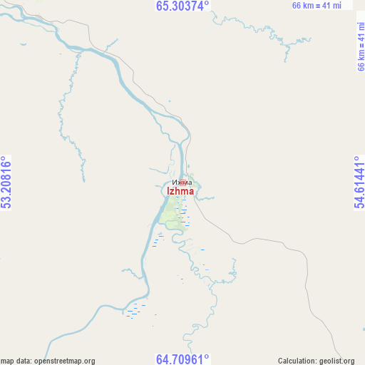
Izhma GPS coordinates[2]
65° 0' 29.988" North, 53° 54' 40.608" East
| Map corner | latitude | longitude |
|---|---|---|
| Upper-left | 65.30374°, | 53.20816° |
| Center: | 65.00833°, | 53.91128° |
| Lower-right: | 64.70961°, | 54.61441° |
| Map W x H: | 66.1×66.1 km | = 41.1×41.1mi |
| max Lat: | 73.50819° ⇑2.4% North |
| Izhma: | 65.00833° |
| min Lat: | ⇓97.6% South 41.28413° |
| min Long | Izhma | max Long |
| -179.12198° | 53.91128° | 179.35046° |
| W 65.6%⇐ | ⇒34.4% E |
Elevation
Elevation of Izhma is 45 m = 148 ft, and this is 157.6 m = 517 ft below average elevation for this country.
| Max E: |
2518 m = 8261 ft | 85.6% |
| Avg. | 202.6 m = 665 ft | |
| Izhma | 45 m = 148 ft | |
Min E: |
-28 m = -92 ft | 14.4% |
See also: Russia elevation on elevation.city.
Geographical zone
Izhma is located in North temperate zone (between Tropic of Cancer and the Arctic Circle). Distance of this North polar circle is 172.9 km =107.4 mi to North.| Distance of | km | miles | from Izhma |
|---|---|---|---|
| North Pole | 2778.8 | 1726.7 | to North |
| Arctic Circle | 172.9 | 107.4 | to North |
| Tropic Cancer | 4622.3 | 2872.2 | to South |
| Equator | 7228.2 | 4491.4 | to South |


Nearby cities:
15 places around Izhma: (largest is in red/bold)
• Borovoy
203.8 km =126.6 mi,  194°
194°
• Kozhva
147.4 km =91.6 mi,  85°
85°
• Nizhniy Odes
158.3 km =98.4 mi,  163°
163°
• Parma
206.5 km =128.3 mi,  57°
57°
• Pechora
156 km =96.9 mi,  84°
84°
• Puteyets
150 km =93.2 mi, 83°
• Shudayag
165.4 km =102.8 mi, 185°
• Sosnogorsk
156.3 km =97.1 mi,  180°
180°
• Ukhta
160.6 km =99.8 mi, 183°
• Usinsk
199.5 km =124 mi, 56°
• Ust-Tsilma
95.1 km =59.1 mi,  300°
300°
• Vodnyy
168.9 km =104.9 mi, 188°
• Voyvozh
240.9 km =149.7 mi,  167°
167°
• Vuktyl
207.3 km =128.8 mi,  128°
128°
• Yarega
175.6 km =109.1 mi, 185°
Sources, notices
• [Note1] Compared only with cities in Russia existing in our database
• [Src1] Map data: © OpenStreetMap contributors (CC-BY-SA)
• [Src2] Other city data from geonames.org with taken over terms of usage.
• [Src3] Geographical zone / Annual Mean Temperature by Robert A. Rohde @ Wikipedia
