Vodnyy geodata
Vodnyy (Komi) is a populated place; located in Russia in Europe/Moscow (GMT+3) time zone. With population of 6,307 people, there are 2177 cities with bigger population in this country. Compared to other cities in Russia, 96.6% of cities are located further ↓South; 65.1% of cities are located further ←West and 71.5% of cities have higher elevation than Vodnyy. Note1


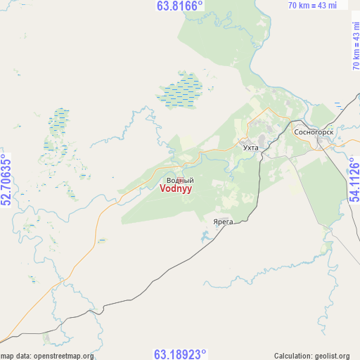
Vodnyy GPS coordinates[2]
63° 30' 16.704" North, 53° 24' 34.092" East
| Map corner | latitude | longitude |
|---|---|---|
| Upper-left | 63.8166°, | 52.70635° |
| Center: | 63.50464°, | 53.40947° |
| Lower-right: | 63.18923°, | 54.1126° |
| Map W x H: | 69.8×69.8 km | = 43.4×43.4mi |
| max Lat: | 73.50819° ⇑3.4% North |
| Vodnyy: | 63.50464° |
| min Lat: | ⇓96.6% South 41.28413° |
| min Long | Vodnyy | max Long |
| -179.12198° | 53.40947° | 179.35046° |
| W 65.1%⇐ | ⇒34.9% E |
Elevation
Elevation of Vodnyy is 99 m = 325 ft, and this is 103.6 m = 340 ft below average elevation for this country.
| Max E: |
2518 m = 8261 ft | 71.5% |
| Avg. | 202.6 m = 665 ft | |
| Vodnyy | 99 m = 325 ft | |
Min E: |
-28 m = -92 ft | 28.5% |
See also: Russia elevation on elevation.city.
Geographical zone
Vodnyy is located in North temperate zone (between Tropic of Cancer and the Arctic Circle). Distance of this North polar circle is 340.1 km =211.3 mi to North.| Distance of | km | miles | from Vodnyy |
|---|---|---|---|
| North Pole | 2946 | 1830.6 | to North |
| Arctic Circle | 340.1 | 211.3 | to North |
| Tropic Cancer | 4455.1 | 2768.3 | to South |
| Equator | 7061.1 | 4387.6 | to South |


Nearby cities:
15 places around Vodnyy: (largest is in red/bold)
• Borovoy
40 km =24.9 mi,  220°
220°
• Izhma
168.9 km =104.9 mi,  8°
8°
• Kortkeros
210.2 km =130.6 mi,  206°
206°
• Nizhniy Odes
73.2 km =45.5 mi,  77°
77°
• Shudayag
10 km =6.2 mi, 75°
• Sindor
104.4 km =64.9 mi,  226°
226°
• Sosnogorsk
25.8 km =16 mi,  65°
65°
• Troitsko-Pechorsk
165.8 km =103 mi,  122°
122°
• Ukhta
15.2 km =9.4 mi,  62°
62°
• Ust’-Kulom
202.7 km =126 mi,  175°
175°
• Ust’-Vym’
208.9 km =129.8 mi, 227°
• Voyvozh
103.5 km =64.3 mi,  131°
131°
• Vuktyl
196.2 km =121.9 mi, 78°
• Yarega
11.3 km =7 mi, 132°
• Yemva
163.9 km =101.8 mi, 231°
Sources, notices
• [Note1] Compared only with cities in Russia existing in our database
• [Src1] Map data: © OpenStreetMap contributors (CC-BY-SA)
• [Src2] Other city data from geonames.org with taken over terms of usage.
• [Src3] Geographical zone / Annual Mean Temperature by Robert A. Rohde @ Wikipedia
