Frolishchi geodata
Frolishchi (Nizhny Novgorod Oblast) is a populated place; located in Russia in Europe/Moscow (GMT+3) time zone. With population of 1,422 people, there are 4418 cities with bigger population in this country. Compared to other cities in Russia, 71.8% of cities are located further ↓South; 58% of cities are located further →East and 68.2% of cities have higher elevation than Frolishchi. Note1


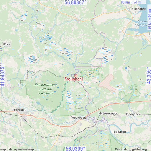
Frolishchi GPS coordinates[2]
56° 25' 18.372" North, 42° 39' 6.732" East
| Map corner | latitude | longitude |
|---|---|---|
| Upper-left | 56.80867°, | 41.94875° |
| Center: | 56.42177°, | 42.65187° |
| Lower-right: | 56.0309°, | 43.355° |
| Map W x H: | 86.5×86.5 km | = 53.7×53.7mi |
| max Lat: | 73.50819° ⇑28.2% North |
| Frolishchi: | 56.42177° |
| min Lat: | ⇓71.8% South 41.28413° |
| min Long | Frolishchi | max Long |
| -179.12198° | 42.65187° | 179.35046° |
| W 42%⇐ | ⇒58% E |
Elevation
Elevation of Frolishchi is 107 m = 351 ft, and this is 95.6 m = 314 ft below average elevation for this country.
| Max E: |
2518 m = 8261 ft | 68.2% |
| Avg. | 202.6 m = 665 ft | |
| Frolishchi | 107 m = 351 ft | |
Min E: |
-28 m = -92 ft | 31.8% |
See also: Russia elevation on elevation.city.
Geographical zone
Frolishchi is located in North temperate zone (between Tropic of Cancer and the Arctic Circle). Distance of this North polar circle is 1127.7 km =700.7 mi to North.| Distance of | km | miles | from Frolishchi |
|---|---|---|---|
| North Pole | 3733.5 | 2319.9 | to North |
| Arctic Circle | 1127.7 | 700.7 | to North |
| Tropic Cancer | 3667.6 | 2278.9 | to South |
| Equator | 6273.5 | 3898.2 | to South |


Nearby cities:
15 places around Frolishchi: (largest is in red/bold)
• Chistoye
25.2 km =15.7 mi,  59°
59°
• Galitsy
29.7 km =18.5 mi,  156°
156°
• Gorokhovets
24.6 km =15.3 mi,  174°
174°
• Ilyinogorsk
28.5 km =17.7 mi,  139°
139°
• Mosta
32.3 km =20.1 mi,  291°
291°
• Mugreyevskiy
27.2 km =16.9 mi,  317°
317°
• Mulino
22.1 km =13.7 mi,  131°
131°
• Novosmolinskiy
28.9 km =18 mi,  121°
121°
• Novovyazniki
38.7 km =24 mi,  229°
229°
• Pestyaki
31.9 km =19.8 mi,  1°
1°
• Purekh
35.7 km =22.2 mi,  45°
45°
• Smolino
31.6 km =19.6 mi, 121°
• Talitsy
22.9 km =14.2 mi,  301°
301°
• Tsentral’nyy
16.2 km =10.1 mi,  148°
148°
• Vyazniki
36.6 km =22.7 mi,  236°
236°
Sources, notices
• [Note1] Compared only with cities in Russia existing in our database
• [Src1] Map data: © OpenStreetMap contributors (CC-BY-SA)
• [Src2] Other city data from geonames.org with taken over terms of usage.
• [Src3] Geographical zone / Annual Mean Temperature by Robert A. Rohde @ Wikipedia
