Pestyaki geodata
Pestyaki (Ivanovo) is a populated place; located in Russia in Europe/Moscow (GMT+3) time zone. With population of 4,172 people, there are 3019 cities with bigger population in this country. Compared to other cities in Russia, 74.5% of cities are located further ↓South; 58% of cities are located further →East and 61.4% of cities have higher elevation than Pestyaki. Note1


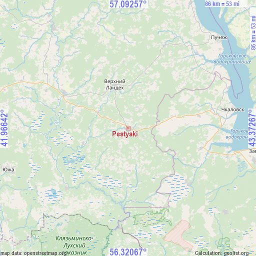
Pestyaki GPS coordinates[2]
56° 42' 30.96" North, 42° 40' 10.344" East
| Map corner | latitude | longitude |
|---|---|---|
| Upper-left | 57.09257°, | 41.96642° |
| Center: | 56.7086°, | 42.66954° |
| Lower-right: | 56.32067°, | 43.37267° |
| Map W x H: | 85.8×85.8 km | = 53.3×53.3mi |
| max Lat: | 73.50819° ⇑25.5% North |
| Pestyaki: | 56.7086° |
| min Lat: | ⇓74.5% South 41.28413° |
| min Long | Pestyaki | max Long |
| -179.12198° | 42.66954° | 179.35046° |
| W 42%⇐ | ⇒58% E |
Elevation
Elevation of Pestyaki is 121 m = 397 ft, and this is 81.6 m = 268 ft below average elevation for this country.
| Max E: |
2518 m = 8261 ft | 61.4% |
| Avg. | 202.6 m = 665 ft | |
| Pestyaki | 121 m = 397 ft | |
Min E: |
-28 m = -92 ft | 38.6% |
See also: Russia elevation on elevation.city.
Geographical zone
Pestyaki is located in North temperate zone (between Tropic of Cancer and the Arctic Circle). Distance of this North polar circle is 1095.8 km =680.9 mi to North.| Distance of | km | miles | from Pestyaki |
|---|---|---|---|
| North Pole | 3701.7 | 2300.1 | to North |
| Arctic Circle | 1095.8 | 680.9 | to North |
| Tropic Cancer | 3699.5 | 2298.8 | to South |
| Equator | 6305.4 | 3918 | to South |


Nearby cities:
15 places around Pestyaki: (largest is in red/bold)
• Chistoye
28 km =17.4 mi,  132°
132°
• Chkalovsk
36.1 km =22.4 mi,  79°
79°
• Frolishchi
31.9 km =19.8 mi,  181°
181°
• Katunki
36.2 km =22.5 mi,  67°
67°
• Lukh
42 km =26.1 mi,  323°
323°
• Mosta
36.8 km =22.9 mi,  237°
237°
• Mugreyevskiy
22.9 km =14.2 mi, 238°
• Pervomayskiy
43.4 km =27 mi,  103°
103°
• Puchezh
42.7 km =26.5 mi,  45°
45°
• Purekh
25.3 km =15.7 mi,  105°
105°
• Talitsy
28.8 km =17.9 mi,  225°
225°
• Tsentral’nyy
46.3 km =28.8 mi,  170°
170°
• Verkhniy Landekh
15.2 km =9.4 mi,  343°
343°
• Yuzha
42.5 km =26.4 mi,  250°
250°
• Zavolzh’ye
44.9 km =27.9 mi, 99°
Sources, notices
• [Note1] Compared only with cities in Russia existing in our database
• [Src1] Map data: © OpenStreetMap contributors (CC-BY-SA)
• [Src2] Other city data from geonames.org with taken over terms of usage.
• [Src3] Geographical zone / Annual Mean Temperature by Robert A. Rohde @ Wikipedia
