Chornoye geodata
Chornoye (Moscow Oblast) is a populated place; located in Russia in Europe/Moscow (GMT+3) time zone. With population of 4,047 people, there are 3083 cities with bigger population in this country. Compared to other cities in Russia, 62.7% of cities are located further ↓South; 76.8% of cities are located further →East and 53.6% of cities have higher elevation than Chornoye. Note1


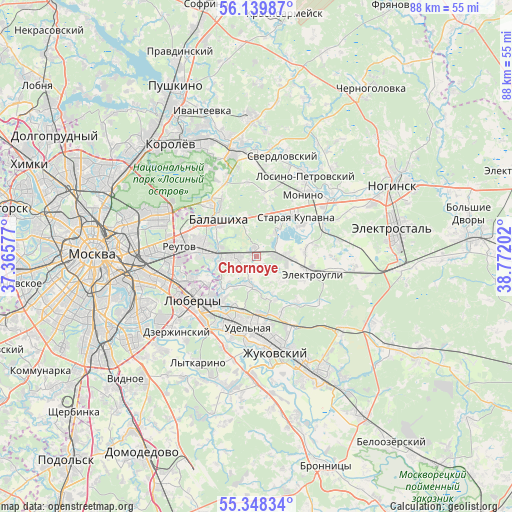
Chornoye GPS coordinates[2]
55° 44' 45.996" North, 38° 4' 8.004" East
| Map corner | latitude | longitude |
|---|---|---|
| Upper-left | 56.13987°, | 37.36577° |
| Center: | 55.74611°, | 38.06889° |
| Lower-right: | 55.34834°, | 38.77202° |
| Map W x H: | 88×88 km | = 54.7×54.7mi |
| max Lat: | 73.50819° ⇑37.3% North |
| Chornoye: | 55.74611° |
| min Lat: | ⇓62.7% South 41.28413° |
| min Long | Chornoye | max Long |
| -179.12198° | 38.06889° | 179.35046° |
| W 23.2%⇐ | ⇒76.8% E |
Elevation
Elevation of Chornoye is 137 m = 449 ft, and this is 65.6 m = 215 ft below average elevation for this country.
| Max E: |
2518 m = 8261 ft | 53.6% |
| Avg. | 202.6 m = 665 ft | |
| Chornoye | 137 m = 449 ft | |
Min E: |
-28 m = -92 ft | 46.4% |
See also: Russia elevation on elevation.city.
Geographical zone
Chornoye is located in North temperate zone (between Tropic of Cancer and the Arctic Circle). Distance of this North polar circle is 1202.8 km =747.4 mi to North.| Distance of | km | miles | from Chornoye |
|---|---|---|---|
| North Pole | 3808.7 | 2366.6 | to North |
| Arctic Circle | 1202.8 | 747.4 | to North |
| Tropic Cancer | 3592.5 | 2232.3 | to South |
| Equator | 6198.4 | 3851.5 | to South |


Nearby cities:
15 places around Chornoye: (largest is in red/bold)
• Balashikha
9.9 km =6.2 mi,  315°
315°
• Elektrougli
9.1 km =5.7 mi,  105°
105°
• Fedurnovo
1.7 km =1.1 mi,  305°
305°
• Korenëvo
9.1 km =5.7 mi,  204°
204°
• Kupavna
3.9 km =2.4 mi,  90°
90°
• Novaya Kupavna
8 km =5 mi,  18°
18°
• Novyy Milet
4.3 km =2.7 mi,  188°
188°
• Purshevo
3.6 km =2.2 mi,  219°
219°
• Rodniki
10.5 km =6.5 mi,  180°
180°
• Rybkhoz
6.3 km =3.9 mi,  40°
40°
• Saltykovka
8.7 km =5.4 mi,  285°
285°
• Staraya Kupavna
9.8 km =6.1 mi,  45°
45°
• Vishnyakovskiye Dachi
4.5 km =2.8 mi,  62°
62°
• Zarya
2 km =1.2 mi, 58°
• Zheleznodorozhnyy
3.3 km =2.1 mi,  265°
265°
Sources, notices
• [Note1] Compared only with cities in Russia existing in our database
• [Src1] Map data: © OpenStreetMap contributors (CC-BY-SA)
• [Src2] Other city data from geonames.org with taken over terms of usage.
• [Src3] Geographical zone / Annual Mean Temperature by Robert A. Rohde @ Wikipedia
