Aleksandrovskaya geodata
Aleksandrovskaya (St.-Petersburg) is a section of populated place; located in Russia in Europe/Moscow (GMT+3) time zone. With population of 4,000 people, there are 3113 cities with bigger population in this country. Compared to other cities in Russia, 90.7% of cities are located further ↓South; 97% of cities are located further →East and 98.8% of cities have higher elevation than Aleksandrovskaya. Note1


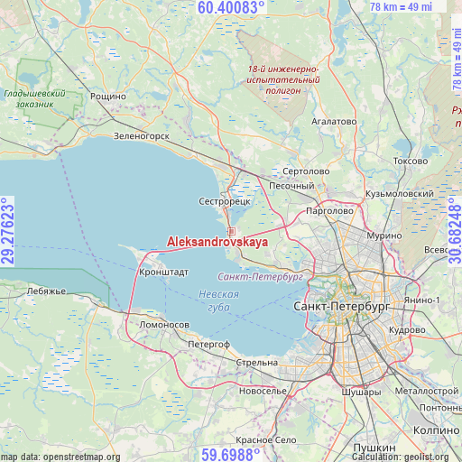
Aleksandrovskaya GPS coordinates[2]
60° 3' 6.048" North, 29° 58' 45.66" East
| Map corner | latitude | longitude |
|---|---|---|
| Upper-left | 60.40083°, | 29.27623° |
| Center: | 60.05168°, | 29.97935° |
| Lower-right: | 59.6988°, | 30.68248° |
| Map W x H: | 78.1×78.1 km | = 48.5×48.5mi |
| max Lat: | 73.50819° ⇑9.3% North |
| Aleksandrovskaya: | 60.05168° |
| min Lat: | ⇓90.7% South 41.28413° |
| min Long | Aleksandrovskay | max Long |
| -179.12198° | 29.97935° | 179.35046° |
| W 3%⇐ | ⇒97% E |
Elevation
Elevation of Aleksandrovskaya is 1 m = 3 ft, and this is 201.6 m = 661 ft below average elevation for this country.
| Max E: |
2518 m = 8261 ft | 98.8% |
| Avg. | 202.6 m = 665 ft | |
| Aleksandrovskaya | 1 m = 3 ft | |
Min E: |
-28 m = -92 ft | 1.2% |
See also: Russia elevation on elevation.city.
Geographical zone
Aleksandrovskaya is located in North temperate zone (between Tropic of Cancer and the Arctic Circle). Distance of this North polar circle is 724.1 km =449.9 mi to North.| Distance of | km | miles | from Aleksandrovskaya |
|---|---|---|---|
| North Pole | 3329.9 | 2069.1 | to North |
| Arctic Circle | 724.1 | 449.9 | to North |
| Tropic Cancer | 4071.2 | 2529.7 | to South |
| Equator | 6677.1 | 4149 | to South |


Nearby cities:
15 places around Aleksandrovskaya: (largest is in red/bold)
• Beloostrov
11.1 km =6.9 mi,  6°
6°
• Gorskaya
0.7 km =0.4 mi,  217°
217°
• Kronshtadt
13.4 km =8.3 mi,  242°
242°
• Kurortnyy
13.3 km =8.3 mi,  342°
342°
• Lakhtinskiy
11.2 km =7 mi,  123°
123°
• Levashovo
13.9 km =8.6 mi,  65°
65°
• Lisiy Nos
4.5 km =2.8 mi,  149°
149°
• Ol’gino
8.9 km =5.5 mi, 121°
• Pesochnyy
12.9 km =8 mi,  52°
52°
• Razliv
3.1 km =1.9 mi,  352°
352°
• Repino
14.7 km =9.1 mi, 335°
• Sestroretsk
5.2 km =3.2 mi, 350°
• Solnechnoye
11.7 km =7.3 mi, 351°
• Tarkhovka
1.7 km =1.1 mi, 350°
• Untolovo
13.5 km =8.4 mi,  108°
108°
Sources, notices
• [Note1] Compared only with cities in Russia existing in our database
• [Src1] Map data: © OpenStreetMap contributors (CC-BY-SA)
• [Src2] Other city data from geonames.org with taken over terms of usage.
• [Src3] Geographical zone / Annual Mean Temperature by Robert A. Rohde @ Wikipedia
