Alandskoye geodata
Alandskoye (Orenburg Oblast) is a populated place; located in Russia in Asia/Yekaterinburg (GMT+5) time zone. With population of 1,418 people, there are 4419 cities with bigger population in this country. Compared to other cities in Russia, 67.8% of cities are located further ↑North; 71.1% of cities are located further ←West and 84.9% of cities have lower elevation than Alandskoye. Note1


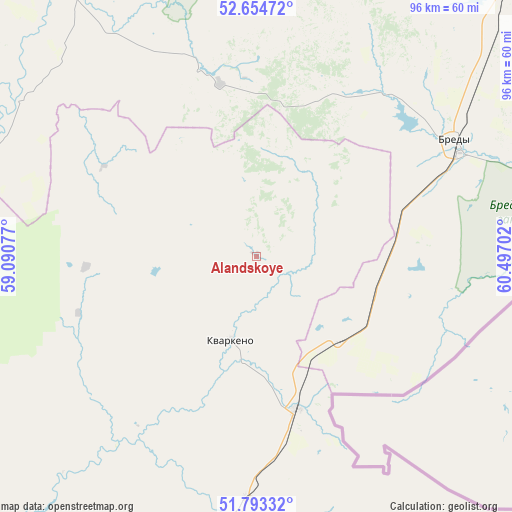
Alandskoye GPS coordinates[2]
52° 13' 33.996" North, 59° 47' 38.004" East
| Map corner | latitude | longitude |
|---|---|---|
| Upper-left | 52.65472°, | 59.09077° |
| Center: | 52.22611°, | 59.79389° |
| Lower-right: | 51.79332°, | 60.49702° |
| Map W x H: | 95.8×95.8 km | = 59.5×59.5mi |
| max Lat: | 73.50819° ⇑67.8% North |
| Alandskoye: | 52.22611° |
| min Lat: | ⇓32.2% South 41.28413° |
| min Long | Alandskoye | max Long |
| -179.12198° | 59.79389° | 179.35046° |
| W 71.1%⇐ | ⇒28.9% E |
Elevation
Elevation of Alandskoye is 318 m = 1043 ft, and this is 115.4 m = 379 ft above average elevation for this country.
| Max E: |
2518 m = 8261 ft | 15.1% |
| Alandskoye | 318 m 1043 ft | |
| Avg. | 202.6 m = 665 ft | |
Min E: |
-28 m = -92 ft | 84.9% |
See also: Russia elevation on elevation.city.
Geographical zone
Alandskoye is located in North temperate zone (between Tropic of Cancer and the Arctic Circle). Distance of this North polar circle is 1594.2 km =990.6 mi to North.| Distance of | km | miles | from Alandskoye |
|---|---|---|---|
| North Pole | 4200.1 | 2609.8 | to North |
| Arctic Circle | 1594.2 | 990.6 | to North |
| Tropic Cancer | 3201.1 | 1989.1 | to South |
| Equator | 5807 | 3608.3 | to South |


Nearby cities:
15 places around Alandskoye: (largest is in red/bold)
• Adamovka
78.9 km =49 mi,  172°
172°
• Ak”yar
115 km =71.5 mi,  249°
249°
• Baymak
107.8 km =67 mi,  292°
292°
• Bredy
42.7 km =26.5 mi,  60°
60°
• Buribay
115.5 km =71.8 mi,  255°
255°
• Energetik
87 km =54.1 mi,  231°
231°
• Kartaly
108.5 km =67.4 mi,  32°
32°
• Krasnoyarskiy
29.9 km =18.6 mi, 166°
• Kvarkeno
16.6 km =10.3 mi,  196°
196°
• Lokomotivnyy
101.8 km =63.3 mi, 30°
• Novoorsk
109.3 km =67.9 mi,  210°
210°
• Parizh
120.9 km =75.1 mi,  9°
9°
• Shil’da
45.8 km =28.5 mi,  181°
181°
• Sibay
94 km =58.4 mi,  305°
305°
• Yelizavetinka
51.1 km =31.8 mi, 183°
Sources, notices
• [Note1] Compared only with cities in Russia existing in our database
• [Src1] Map data: © OpenStreetMap contributors (CC-BY-SA)
• [Src2] Other city data from geonames.org with taken over terms of usage.
• [Src3] Geographical zone / Annual Mean Temperature by Robert A. Rohde @ Wikipedia
