Buribay geodata
Buribay (Bashkortostan Republic) is a populated place; located in Russia in Asia/Yekaterinburg (GMT+5) time zone. With population of 4,461 people, there are 2881 cities with bigger population in this country. Compared to other cities in Russia, 69.4% of cities are located further ↑North; 69.6% of cities are located further ←West and 85.7% of cities have lower elevation than Buribay. Note1


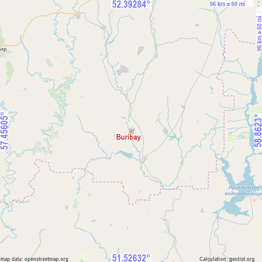
Buribay GPS coordinates[2]
51° 57' 42.012" North, 58° 9' 33.012" East
| Map corner | latitude | longitude |
|---|---|---|
| Upper-left | 52.39284°, | 57.45605° |
| Center: | 51.96167°, | 58.15917° |
| Lower-right: | 51.52632°, | 58.8623° |
| Map W x H: | 96.3×96.3 km | = 59.8×59.8mi |
| max Lat: | 73.50819° ⇑69.4% North |
| Buribay: | 51.96167° |
| min Lat: | ⇓30.6% South 41.28413° |
| min Long | Buribay | max Long |
| -179.12198° | 58.15917° | 179.35046° |
| W 69.6%⇐ | ⇒30.4% E |
Elevation
Elevation of Buribay is 337 m = 1106 ft, and this is 134.4 m = 441 ft above average elevation for this country.
| Max E: |
2518 m = 8261 ft | 14.3% |
| Buribay | 337 m 1106 ft | |
| Avg. | 202.6 m = 665 ft | |
Min E: |
-28 m = -92 ft | 85.7% |
See also: Russia elevation on elevation.city.
Geographical zone
Buribay is located in North temperate zone (between Tropic of Cancer and the Arctic Circle). Distance of this North polar circle is 1623.6 km =1008.9 mi to North.| Distance of | km | miles | from Buribay |
|---|---|---|---|
| North Pole | 4229.5 | 2628.1 | to North |
| Arctic Circle | 1623.6 | 1008.9 | to North |
| Tropic Cancer | 3171.7 | 1970.8 | to South |
| Equator | 5777.6 | 3590 | to South |


Nearby cities:
15 places around Buribay: (largest is in red/bold)
• Ak”yar
12.2 km =7.6 mi,  159°
159°
• Baymak
71.1 km =44.2 mi,  8°
8°
• Energetik
49.8 km =30.9 mi,  119°
119°
• Gay
58.7 km =36.5 mi, 159°
• Kuvandyk
77.2 km =48 mi,  225°
225°
• Kvarkeno
108 km =67.1 mi,  82°
82°
• Mednogorsk
72.4 km =45 mi,  212°
212°
• Novoorsk
85.9 km =53.4 mi,  138°
138°
• Novorudnyy
51.1 km =31.8 mi,  177°
177°
• Novotroitsk
85.1 km =52.9 mi,  172°
172°
• Orsk
88.7 km =55.1 mi, 161°
• Sibay
90.9 km =56.5 mi,  22°
22°
• Staraya Akkermanovka
79.7 km =49.5 mi, 176°
• Tubinskiy
103.2 km =64.1 mi,  2°
2°
• Zilair
57.7 km =35.9 mi,  301°
301°
Sources, notices
• [Note1] Compared only with cities in Russia existing in our database
• [Src1] Map data: © OpenStreetMap contributors (CC-BY-SA)
• [Src2] Other city data from geonames.org with taken over terms of usage.
• [Src3] Geographical zone / Annual Mean Temperature by Robert A. Rohde @ Wikipedia
