Vasil’yevo geodata
Vasil’yevo (Tatarstan Republic) is a populated place; located in Russia in Europe/Moscow (GMT+3) time zone. With population of 16,800 people, there are 1007 cities with bigger population in this country. Compared to other cities in Russia, 64.1% of cities are located further ↓South; 60.3% of cities are located further ←West and 83% of cities have higher elevation than Vasil’yevo. Note1


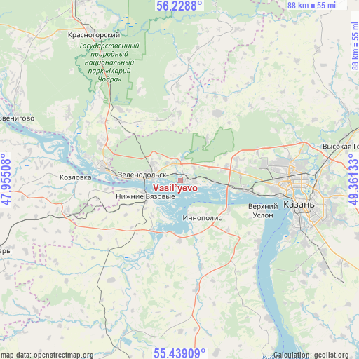
Vasil’yevo GPS coordinates[2]
55° 50' 9.42" North, 48° 39' 29.52" East
| Map corner | latitude | longitude |
|---|---|---|
| Upper-left | 56.2288°, | 47.95508° |
| Center: | 55.83595°, | 48.6582° |
| Lower-right: | 55.43909°, | 49.36133° |
| Map W x H: | 87.8×87.8 km | = 54.6×54.6mi |
| max Lat: | 73.50819° ⇑35.9% North |
| Vasil’yevo: | 55.83595° |
| min Lat: | ⇓64.1% South 41.28413° |
| min Long | Vasil’yevo | max Long |
| -179.12198° | 48.6582° | 179.35046° |
| W 60.3%⇐ | ⇒39.7% E |
Elevation
Elevation of Vasil’yevo is 58 m = 190 ft, and this is 144.6 m = 474 ft below average elevation for this country.
| Max E: |
2518 m = 8261 ft | 83% |
| Avg. | 202.6 m = 665 ft | |
| Vasil’yevo | 58 m = 190 ft | |
Min E: |
-28 m = -92 ft | 17% |
See also: Russia elevation on elevation.city.
Geographical zone
Vasil’yevo is located in North temperate zone (between Tropic of Cancer and the Arctic Circle). Distance of this North polar circle is 1192.8 km =741.2 mi to North.| Distance of | km | miles | from Vasil’yevo |
|---|---|---|---|
| North Pole | 3798.7 | 2360.4 | to North |
| Arctic Circle | 1192.8 | 741.2 | to North |
| Tropic Cancer | 3602.5 | 2238.5 | to South |
| Equator | 6208.4 | 3857.7 | to South |


Nearby cities:
15 places around Vasil’yevo: (largest is in red/bold)
• Aysha
4.2 km =2.6 mi,  336°
336°
• Kazan
29.5 km =18.3 mi,  100°
100°
• Kozlovka
25.5 km =15.8 mi,  271°
271°
• Krasnogorskiy
40.8 km =25.4 mi,  329°
329°
• Nizhniye Vyazovyye
9.3 km =5.8 mi,  243°
243°
• Osinovo
14.8 km =9.2 mi,  70°
70°
• Pomary
24.2 km =15 mi,  307°
307°
• Privolzhskiy
20.6 km =12.8 mi, 312°
• Staroye Arakchino
19.9 km =12.4 mi, 100°
• Stolbishchi
40.8 km =25.4 mi,  121°
121°
• Sviyazhsk
7 km =4.3 mi,  178°
178°
• Verkhniy Uslon
21.5 km =13.4 mi,  109°
109°
• Volzhsk
19 km =11.8 mi,  280°
280°
• Vysokaya Gora
41 km =25.5 mi,  77°
77°
• Zelenodolsk
8.8 km =5.5 mi, 275°
Sources, notices
• [Note1] Compared only with cities in Russia existing in our database
• [Src1] Map data: © OpenStreetMap contributors (CC-BY-SA)
• [Src2] Other city data from geonames.org with taken over terms of usage.
• [Src3] Geographical zone / Annual Mean Temperature by Robert A. Rohde @ Wikipedia
