Vysokaya Gora geodata
Vysokaya Gora (Tatarstan Republic) is a populated place; located in Russia in Europe/Moscow (GMT+3) time zone. With population of 8,013 people, there are 1795 cities with bigger population in this country. Compared to other cities in Russia, 65.3% of cities are located further ↓South; 61.1% of cities are located further ←West and 70.2% of cities have higher elevation than Vysokaya Gora. Note1


Vysokaya Gora GPS coordinates[2]
55° 54' 46.008" North, 49° 18' 6.012" East
| Map corner | latitude | longitude |
|---|---|---|
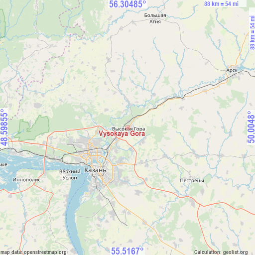
| Upper-left | 56.30485°, | 48.59855° |
| Center: | 55.91278°, | 49.30167° |
| Lower-right: | 55.5167°, | 50.0048° |
| Map W x H: | 87.6×87.6 km | = 54.4×54.4mi |
| max Lat: | 73.50819° ⇑34.7% North |
| Vysokaya Gora: | 55.91278° |
| min Lat: | ⇓65.3% South 41.28413° |
| min Long | Vysokaya Gora | max Long |
| -179.12198° | 49.30167° | 179.35046° |
| W 61.1%⇐ | ⇒38.9% E |
Elevation
Elevation of Vysokaya Gora is 102 m = 335 ft, and this is 100.6 m = 330 ft below average elevation for this country.
| Max E: |
2518 m = 8261 ft | 70.2% |
| Avg. | 202.6 m = 665 ft | |
| Vysokaya Gora | 102 m = 335 ft | |
Min E: |
-28 m = -92 ft | 29.8% |
See also: Russia elevation on elevation.city.
Geographical zone
Vysokaya Gora is located in North temperate zone (between Tropic of Cancer and the Arctic Circle). Distance of this North polar circle is 1184.3 km =735.9 mi to North.| Distance of | km | miles | from Vysokaya Gora |
|---|---|---|---|
| North Pole | 3790.1 | 2355.1 | to North |
| Arctic Circle | 1184.3 | 735.9 | to North |
| Tropic Cancer | 3611 | 2243.8 | to South |
| Equator | 6216.9 | 3863 | to South |


Nearby cities:
15 places around Vysokaya Gora: (largest is in red/bold)
• Arsk
41 km =25.5 mi,  60°
60°
• Aysha
42 km =26.1 mi,  263°
263°
• Kazan
17.8 km =11.1 mi,  219°
219°
• Laishevo
58.6 km =36.4 mi,  164°
164°
• Nizhniye Vyazovyye
50.1 km =31.1 mi, 255°
• Osinovo
26.5 km =16.5 mi, 262°
• Pestretsy
28.3 km =17.6 mi,  128°
128°
• Privolzhskiy
55.5 km =34.5 mi,  275°
275°
• Staroye Arakchino
23.9 km =14.9 mi,  239°
239°
• Stolbishchi
30.1 km =18.7 mi,  190°
190°
• Sviyazhsk
42.9 km =26.7 mi,  248°
248°
• Tyulyachi
58.5 km =36.4 mi,  92°
92°
• Vasil’yevo
41 km =25.5 mi, 257°
• Verkhniy Uslon
25.5 km =15.8 mi,  231°
231°
• Zelenodolsk
49.5 km =30.8 mi, 261°
Sources, notices
• [Note1] Compared only with cities in Russia existing in our database
• [Src1] Map data: © OpenStreetMap contributors (CC-BY-SA)
• [Src2] Other city data from geonames.org with taken over terms of usage.
• [Src3] Geographical zone / Annual Mean Temperature by Robert A. Rohde @ Wikipedia
