Pervomayskoye geodata
Pervomayskoye (Dagestan) is a populated place; located in Russia in Europe/Moscow (GMT+3) time zone. With population of 9,073 people, there are 1642 cities with bigger population in this country. Compared to other cities in Russia, 92.2% of cities are located further ↑North; 54.9% of cities are located further ←West and 99.3% of cities have higher elevation than Pervomayskoye. Note1


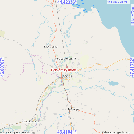
Pervomayskoye GPS coordinates[2]
43° 55' 8.544" North, 46° 42' 36.684" East
| Map corner | latitude | longitude |
|---|---|---|
| Upper-left | 44.42336°, | 46.00707° |
| Center: | 43.91904°, | 46.71019° |
| Lower-right: | 43.41041°, | 47.41332° |
| Map W x H: | 112.6×112.6 km | = 70×70mi |
| max Lat: | 73.50819° ⇑92.2% North |
| Pervomayskoye: | 43.91904° |
| min Lat: | ⇓7.8% South 41.28413° |
| min Long | Pervomayskoye | max Long |
| -179.12198° | 46.71019° | 179.35046° |
| W 54.9%⇐ | ⇒45.1% E |
Elevation
Elevation of Pervomayskoye is -11 m = -36 ft, and this is 213.6 m = 701 ft below average elevation for this country.
| Max E: |
2518 m = 8261 ft | 99.3% |
| Avg. | 202.6 m = 665 ft | |
| Pervomayskoye | -11 m = -36 ft | |
Min E: |
-28 m = -92 ft | 0.7% |
See also: Russia elevation on elevation.city.
Geographical zone
Pervomayskoye is located in North temperate zone (between Tropic of Cancer and the Arctic Circle). Distance of this Northern Tropic circle is 2277.4 km =1415.1 mi to South.| Distance of | km | miles | from Pervomayskoye |
|---|---|---|---|
| North Pole | 5123.7 | 3183.7 | to North |
| Arctic Circle | 2517.8 | 1564.5 | to North |
| Tropic Cancer | 2277.4 | 1415.1 | to South |
| Equator | 4883.3 | 3034.3 | to South |


Nearby cities:
15 places around Pervomayskoye: (largest is in red/bold)
• Adil’-Yangiyurt
40.8 km =25.4 mi,  194°
194°
• Aksay
64.4 km =40 mi,  199°
199°
• Babayurt
35.9 km =22.3 mi,  171°
171°
• Bammatyurt
64.3 km =40 mi, 187°
• Grebenskaya
51 km =31.7 mi,  212°
212°
• Kargalinskaya
26.9 km =16.7 mi,  223°
223°
• Khamamatyurt
38.5 km =23.9 mi, 205°
• Kizlyar
8 km =5 mi,  177°
177°
• Kochubey
52.9 km =32.9 mi,  348°
348°
• Komsomol’skiy
6.7 km =4.2 mi, 351°
• Kostek
65 km =40.4 mi, 169°
• Novogagatli
54.6 km =33.9 mi, 199°
• Shëlkovskaya
54.5 km =33.9 mi, 213°
• Tarumovka
22.3 km =13.9 mi,  321°
321°
• Utsmiyurt
46.9 km =29.1 mi, 204°
Sources, notices
• [Note1] Compared only with cities in Russia existing in our database
• [Src1] Map data: © OpenStreetMap contributors (CC-BY-SA)
• [Src2] Other city data from geonames.org with taken over terms of usage.
• [Src3] Geographical zone / Annual Mean Temperature by Robert A. Rohde @ Wikipedia
