Troitskoye geodata
Troitskoye (Altai Krai) is a populated place; located in Russia in Asia/Barnaul (GMT+7) time zone. With population of 10,887 people, there are 1388 cities with bigger population in this country. Compared to other cities in Russia, 62.9% of cities are located further ↑North; 81.9% of cities are located further ←West and 77.1% of cities have lower elevation than Troitskoye. Note1


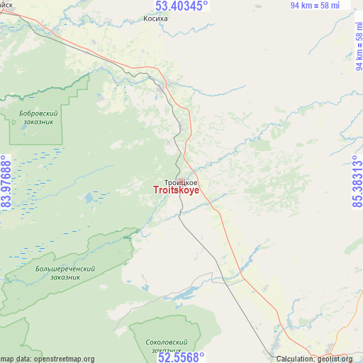
Troitskoye GPS coordinates[2]
52° 58' 55.92" North, 84° 40' 48" East
| Map corner | latitude | longitude |
|---|---|---|
| Upper-left | 53.40345°, | 83.97688° |
| Center: | 52.9822°, | 84.68° |
| Lower-right: | 52.5568°, | 85.38313° |
| Map W x H: | 94.1×94.1 km | = 58.5×58.5mi |
| max Lat: | 73.50819° ⇑62.9% North |
| Troitskoye: | 52.9822° |
| min Lat: | ⇓37.1% South 41.28413° |
| min Long | Troitskoye | max Long |
| -179.12198° | 84.68° | 179.35046° |
| W 81.9%⇐ | ⇒18.1% E |
Elevation
Elevation of Troitskoye is 227 m = 745 ft, and this is 24.4 m = 80 ft above average elevation for this country.
| Max E: |
2518 m = 8261 ft | 22.9% |
| Troitskoye | 227 m 745 ft | |
| Avg. | 202.6 m = 665 ft | |
Min E: |
-28 m = -92 ft | 77.1% |
See also: Russia elevation on elevation.city.
Geographical zone
Troitskoye is located in North temperate zone (between Tropic of Cancer and the Arctic Circle). Distance of this North polar circle is 1510.1 km =938.3 mi to North.| Distance of | km | miles | from Troitskoye |
|---|---|---|---|
| North Pole | 4116 | 2557.6 | to North |
| Arctic Circle | 1510.1 | 938.3 | to North |
| Tropic Cancer | 3285.1 | 2041.3 | to South |
| Equator | 5891.1 | 3660.6 | to South |


Nearby cities:
15 places around Troitskoye: (largest is in red/bold)
• Bayunovskiye Klyuchi
50.8 km =31.6 mi,  319°
319°
• Biysk
61 km =37.9 mi,  144°
144°
• Bobrovka
58.2 km =36.2 mi,  292°
292°
• Firsovo
61.1 km =38 mi,  307°
307°
• Kosikha
42.7 km =26.5 mi,  351°
351°
• Lesnoy
55.4 km =34.4 mi,  301°
301°
• Nalobikha
24.9 km =15.5 mi, 347°
• Pervomayskoye
57.7 km =35.9 mi, 137°
• Sannikovo
61.9 km =38.5 mi, 310°
• Shubenka
46 km =28.6 mi, 142°
• Sokolovo
50.6 km =31.4 mi,  171°
171°
• Sukhaya Chemrovka
55.8 km =34.7 mi,  120°
120°
• Verkh-Marushka
63.9 km =39.7 mi,  96°
96°
• Zarya
54.3 km =33.7 mi, 142°
• Zonal’noye
39 km =24.2 mi,  154°
154°
Sources, notices
• [Note1] Compared only with cities in Russia existing in our database
• [Src1] Map data: © OpenStreetMap contributors (CC-BY-SA)
• [Src2] Other city data from geonames.org with taken over terms of usage.
• [Src3] Geographical zone / Annual Mean Temperature by Robert A. Rohde @ Wikipedia
