Khudoyelanskoye geodata
Khudoyelanskoye (Irkutsk Oblast) is a populated place; located in Russia in Asia/Irkutsk (GMT+8) time zone. With population of 2,000 people, there are 4146 cities with bigger population in this country. Compared to other cities in Russia, 50.5% of cities are located further ↓South; 88% of cities are located further ←West and 94% of cities have lower elevation than Khudoyelanskoye. Note1


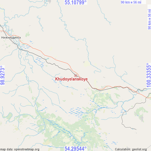
Khudoyelanskoye GPS coordinates[2]
54° 42' 13.5" North, 99° 37' 49.512" East
| Map corner | latitude | longitude |
|---|---|---|
| Upper-left | 55.10799°, | 98.9273° |
| Center: | 54.70375°, | 99.63042° |
| Lower-right: | 54.29544°, | 100.33355° |
| Map W x H: | 90.3×90.3 km | = 56.1×56.1mi |
| max Lat: | 73.50819° ⇑49.5% North |
| Khudoyelanskoye: | 54.70375° |
| min Lat: | ⇓50.5% South 41.28413° |
| min Long | Khudoyelanskoye | max Long |
| -179.12198° | 99.63042° | 179.35046° |
| W 88%⇐ | ⇒12% E |
Elevation
Elevation of Khudoyelanskoye is 582 m = 1909 ft, and this is 379.4 m = 1245 ft above average elevation for this country.
| Max E: |
2518 m = 8261 ft | 6% |
| Khudoyelanskoye | 582 m 1909 ft | |
| Avg. | 202.6 m = 665 ft | |
Min E: |
-28 m = -92 ft | 94% |
See also: Russia elevation on elevation.city.
Geographical zone
Khudoyelanskoye is located in North temperate zone (between Tropic of Cancer and the Arctic Circle). Distance of this North polar circle is 1318.7 km =819.4 mi to North.| Distance of | km | miles | from Khudoyelanskoye |
|---|---|---|---|
| North Pole | 3924.6 | 2438.6 | to North |
| Arctic Circle | 1318.7 | 819.4 | to North |
| Tropic Cancer | 3476.6 | 2160.3 | to South |
| Equator | 6082.5 | 3779.5 | to South |


Nearby cities:
15 places around Khudoyelanskoye: (largest is in red/bold)
• Afanas’yeva
63.9 km =39.7 mi,  96°
96°
• Algatuy
52.5 km =32.6 mi,  129°
129°
• Atagay
47.1 km =29.3 mi,  340°
340°
• Budagovo
33.4 km =20.8 mi,  105°
105°
• Ikey
63.9 km =39.7 mi,  152°
152°
• Kotik
53.3 km =33.1 mi, 96°
• Mugun
47.5 km =29.5 mi,  122°
122°
• Nizhneudinsk
44.8 km =27.8 mi,  300°
300°
• Perfilovo
64 km =39.8 mi, 120°
• Sheberta
18.2 km =11.3 mi, 112°
• Shumskiy
35 km =21.7 mi,  294°
294°
• Tselinnyye Zemli
64.1 km =39.8 mi,  90°
90°
• Tulun
63.2 km =39.3 mi, 104°
• Voznesenskiy
40 km =24.9 mi, 302°
• Yedogon
63.5 km =39.5 mi,  141°
141°
Sources, notices
• [Note1] Compared only with cities in Russia existing in our database
• [Src1] Map data: © OpenStreetMap contributors (CC-BY-SA)
• [Src2] Other city data from geonames.org with taken over terms of usage.
• [Src3] Geographical zone / Annual Mean Temperature by Robert A. Rohde @ Wikipedia
