Atagay geodata
Atagay (Irkutsk Oblast) is a populated place; located in Russia in Asia/Irkutsk (GMT+8) time zone. With population of 1,805 people, there are 4249 cities with bigger population in this country. Compared to other cities in Russia, 54.4% of cities are located further ↓South; 87.9% of cities are located further ←West and 86.5% of cities have lower elevation than Atagay. Note1


Atagay GPS coordinates[2]
55° 6' 11.88" North, 99° 23' 15" East
| Map corner | latitude | longitude |
|---|---|---|
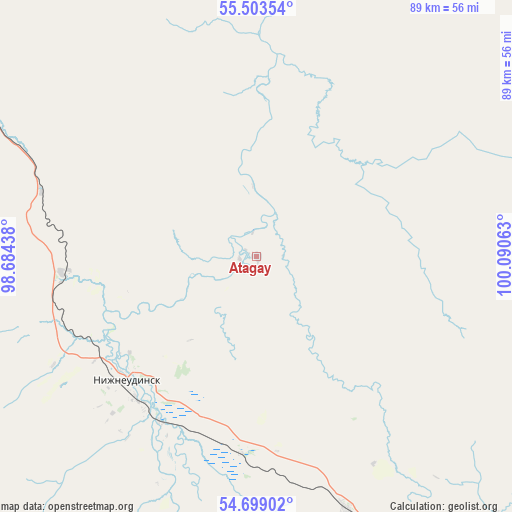
| Upper-left | 55.50354°, | 98.68438° |
| Center: | 55.1033°, | 99.3875° |
| Lower-right: | 54.69902°, | 100.09063° |
| Map W x H: | 89.5×89.5 km | = 55.6×55.6mi |
| max Lat: | 73.50819° ⇑45.6% North |
| Atagay: | 55.1033° |
| min Lat: | ⇓54.4% South 41.28413° |
| min Long | Atagay | max Long |
| -179.12198° | 99.3875° | 179.35046° |
| W 87.9%⇐ | ⇒12.1% E |
Elevation
Elevation of Atagay is 355 m = 1165 ft, and this is 152.4 m = 500 ft above average elevation for this country.
| Max E: |
2518 m = 8261 ft | 13.5% |
| Atagay | 355 m 1165 ft | |
| Avg. | 202.6 m = 665 ft | |
Min E: |
-28 m = -92 ft | 86.5% |
See also: Russia elevation on elevation.city.
Geographical zone
Atagay is located in North temperate zone (between Tropic of Cancer and the Arctic Circle). Distance of this North polar circle is 1274.3 km =791.8 mi to North.| Distance of | km | miles | from Atagay |
|---|---|---|---|
| North Pole | 3880.1 | 2411 | to North |
| Arctic Circle | 1274.3 | 791.8 | to North |
| Tropic Cancer | 3521 | 2187.8 | to South |
| Equator | 6126.9 | 3807.1 | to South |


Nearby cities:
15 places around Atagay: (largest is in red/bold)
• Afanas’yeva
94.1 km =58.5 mi,  123°
123°
• Algatuy
95.9 km =59.6 mi,  144°
144°
• Alzamay
68 km =42.3 mi,  317°
317°
• Budagovo
71.3 km =44.3 mi, 138°
• Guran
88.8 km =55.2 mi, 115°
• Ilir
83.5 km =51.9 mi,  80°
80°
• Khudoyelanskoye
47.1 km =29.3 mi,  160°
160°
• Kotik
84.8 km =52.7 mi,  126°
126°
• Mugun
89.3 km =55.5 mi, 141°
• Nizhneudinsk
31.6 km =19.6 mi,  226°
226°
• Sheberta
60.6 km =37.7 mi,  147°
147°
• Shumskiy
34.3 km =21.3 mi,  208°
208°
• Tselinnyye Zemli
91.3 km =56.7 mi, 119°
• Uk
33.8 km =21 mi,  265°
265°
• Voznesenskiy
29.3 km =18.2 mi,  218°
218°
Sources, notices
• [Note1] Compared only with cities in Russia existing in our database
• [Src1] Map data: © OpenStreetMap contributors (CC-BY-SA)
• [Src2] Other city data from geonames.org with taken over terms of usage.
• [Src3] Geographical zone / Annual Mean Temperature by Robert A. Rohde @ Wikipedia
