Kedrovoye geodata
Kedrovoye (Sverdlovsk) is a populated place; located in Russia in Asia/Yekaterinburg (GMT+5) time zone. With population of 2,163 people, there are 4090 cities with bigger population in this country. Compared to other cities in Russia, 78.4% of cities are located further ↓South; 72.6% of cities are located further ←West and 81.7% of cities have lower elevation than Kedrovoye. Note1


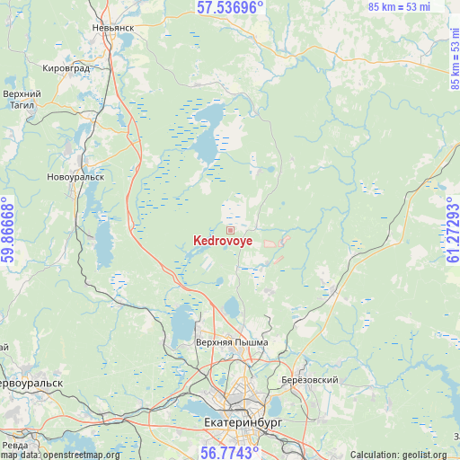
Kedrovoye GPS coordinates[2]
57° 9' 27.36" North, 60° 34' 11.28" East
| Map corner | latitude | longitude |
|---|---|---|
| Upper-left | 57.53696°, | 59.86668° |
| Center: | 57.1576°, | 60.5698° |
| Lower-right: | 56.7743°, | 61.27293° |
| Map W x H: | 84.8×84.8 km | = 52.7×52.7mi |
| max Lat: | 73.50819° ⇑21.6% North |
| Kedrovoye: | 57.1576° |
| min Lat: | ⇓78.4% South 41.28413° |
| min Long | Kedrovoye | max Long |
| -179.12198° | 60.5698° | 179.35046° |
| W 72.6%⇐ | ⇒27.4% E |
Elevation
Elevation of Kedrovoye is 270 m = 886 ft, and this is 67.4 m = 221 ft above average elevation for this country.
| Max E: |
2518 m = 8261 ft | 18.3% |
| Kedrovoye | 270 m 886 ft | |
| Avg. | 202.6 m = 665 ft | |
Min E: |
-28 m = -92 ft | 81.7% |
See also: Russia elevation on elevation.city.
Geographical zone
Kedrovoye is located in North temperate zone (between Tropic of Cancer and the Arctic Circle). Distance of this North polar circle is 1045.8 km =649.8 mi to North.| Distance of | km | miles | from Kedrovoye |
|---|---|---|---|
| North Pole | 3651.7 | 2269.1 | to North |
| Arctic Circle | 1045.8 | 649.8 | to North |
| Tropic Cancer | 3749.4 | 2329.8 | to South |
| Equator | 6355.3 | 3949 | to South |


Nearby cities:
15 places around Kedrovoye: (largest is in red/bold)
• Ayat’
24.6 km =15.3 mi,  235°
235°
• Beryozovsky
31.1 km =19.3 mi,  153°
153°
• Iset’
23.3 km =14.5 mi,  210°
210°
• Kalinovo
25.7 km =16 mi,  263°
263°
• Klyuchevsk
22.8 km =14.2 mi,  100°
100°
• Losinyy
30 km =18.6 mi,  94°
94°
• Monetnyy
22.4 km =13.9 mi,  123°
123°
• Neyvo-Rudyanka
33.4 km =20.8 mi,  308°
308°
• Novoural’sk
30.8 km =19.1 mi,  288°
288°
• Shuvakish
27.1 km =16.8 mi,  191°
191°
• Sredneuralsk
19.7 km =12.2 mi,  198°
198°
• Staropyshminsk
31.6 km =19.6 mi,  140°
140°
• Tavatuy
21.8 km =13.5 mi,  268°
268°
• Verkh-Neyvinskiy
28.9 km =18 mi,  295°
295°
• Verkhnyaya Pyshma
20.8 km =12.9 mi,  177°
177°
Sources, notices
• [Note1] Compared only with cities in Russia existing in our database
• [Src1] Map data: © OpenStreetMap contributors (CC-BY-SA)
• [Src2] Other city data from geonames.org with taken over terms of usage.
• [Src3] Geographical zone / Annual Mean Temperature by Robert A. Rohde @ Wikipedia
