Dalmatovo geodata
Dalmatovo (Kurgan Oblast) is a populated place; located in Russia in Asia/Yekaterinburg (GMT+5) time zone. With population of 14,526 people, there are 1116 cities with bigger population in this country. Compared to other cities in Russia, 70.1% of cities are located further ↓South; 74.9% of cities are located further ←West and 68.8% of cities have higher elevation than Dalmatovo. Note1


Dalmatovo GPS coordinates[2]
56° 15' 36" North, 62° 56' 10.32" East
| Map corner | latitude | longitude |
|---|---|---|
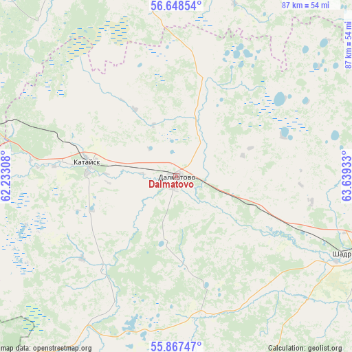
| Upper-left | 56.64854°, | 62.23308° |
| Center: | 56.26°, | 62.9362° |
| Lower-right: | 55.86747°, | 63.63933° |
| Map W x H: | 86.8×86.8 km | = 53.9×53.9mi |
| max Lat: | 73.50819° ⇑29.9% North |
| Dalmatovo: | 56.26° |
| min Lat: | ⇓70.1% South 41.28413° |
| min Long | Dalmatovo | max Long |
| -179.12198° | 62.9362° | 179.35046° |
| W 74.9%⇐ | ⇒25.1% E |
Elevation
Elevation of Dalmatovo is 105 m = 344 ft, and this is 97.6 m = 320 ft below average elevation for this country.
| Max E: |
2518 m = 8261 ft | 68.8% |
| Avg. | 202.6 m = 665 ft | |
| Dalmatovo | 105 m = 344 ft | |
Min E: |
-28 m = -92 ft | 31.2% |
See also: Russia elevation on elevation.city.
Geographical zone
Dalmatovo is located in North temperate zone (between Tropic of Cancer and the Arctic Circle). Distance of this North polar circle is 1145.6 km =711.8 mi to North.| Distance of | km | miles | from Dalmatovo |
|---|---|---|---|
| North Pole | 3751.5 | 2331.1 | to North |
| Arctic Circle | 1145.6 | 711.8 | to North |
| Tropic Cancer | 3649.6 | 2267.8 | to South |
| Equator | 6255.5 | 3887 | to South |


Nearby cities:
15 places around Dalmatovo: (largest is in red/bold)
• Barannikova
61.4 km =38.2 mi,  351°
351°
• Butka
72.9 km =45.3 mi,  45°
45°
• Cheremysh
67 km =41.6 mi,  6°
6°
• Fadyushina
60 km =37.3 mi, 347°
• Galkinskoye
73 km =45.4 mi, 349°
• Kamensk-Ural’skiy
64.3 km =40 mi,  285°
285°
• Kamyshlov
66.3 km =41.2 mi, 347°
• Kataysk
22 km =13.7 mi,  278°
278°
• Martyush
66.8 km =41.5 mi, 283°
• Nikol’skoye
65.1 km =40.5 mi,  0°
0°
• Obukhovskoye
66.9 km =41.6 mi,  342°
342°
• Shadrinsk
47.3 km =29.4 mi,  114°
114°
• Skatinskoye
51.7 km =32.1 mi, 354°
• Ust’-Bagaryak
68.8 km =42.8 mi,  258°
258°
• Yelanskiy
70 km =43.5 mi, 337°
Sources, notices
• [Note1] Compared only with cities in Russia existing in our database
• [Src1] Map data: © OpenStreetMap contributors (CC-BY-SA)
• [Src2] Other city data from geonames.org with taken over terms of usage.
• [Src3] Geographical zone / Annual Mean Temperature by Robert A. Rohde @ Wikipedia
