Kamensk-Ural’skiy geodata
Kamensk-Ural’skiy (Sverdlovsk) is a populated place; located in Russia in Asia/Yekaterinburg (GMT+5) time zone. With population of 182,500 people, there are 107 cities with bigger population in this country. Compared to other cities in Russia, 71.7% of cities are located further ↓South; 74.5% of cities are located further ←West and 61.6% of cities have lower elevation than Kamensk-Ural’skiy. Note1


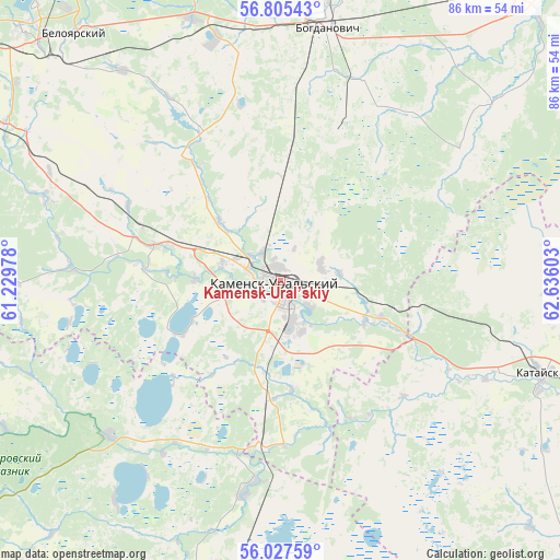
Kamensk-Ural’skiy GPS coordinates[2]
56° 25' 6.6" North, 61° 55' 58.44" East
| Map corner | latitude | longitude |
|---|---|---|
| Upper-left | 56.80543°, | 61.22978° |
| Center: | 56.4185°, | 61.9329° |
| Lower-right: | 56.02759°, | 62.63603° |
| Map W x H: | 86.5×86.5 km | = 53.7×53.7mi |
| max Lat: | 73.50819° ⇑28.3% North |
| Kamensk-Ural’skiy: | 56.4185° |
| min Lat: | ⇓71.7% South 41.28413° |
| min Long | Kamensk-Ural’ | max Long |
| -179.12198° | 61.9329° | 179.35046° |
| W 74.5%⇐ | ⇒25.5% E |
Elevation
Elevation of Kamensk-Ural’skiy is 173 m = 568 ft, and this is 29.6 m = 97 ft below average elevation for this country.
| Max E: |
2518 m = 8261 ft | 38.4% |
| Avg. | 202.6 m = 665 ft | |
| Kamensk-Ural’skiy | 173 m = 568 ft | |
Min E: |
-28 m = -92 ft | 61.6% |
See also: Kamensk-Ural’skiy elevation on elevation.city.
Geographical zone
Kamensk-Ural’skiy is located in North temperate zone (between Tropic of Cancer and the Arctic Circle). Distance of this North polar circle is 1128 km =700.9 mi to North.| Distance of | km | miles | from Kamensk-Ural’skiy |
|---|---|---|---|
| North Pole | 3733.9 | 2320.1 | to North |
| Arctic Circle | 1128 | 700.9 | to North |
| Tropic Cancer | 3667.2 | 2278.7 | to South |
| Equator | 6273.1 | 3897.9 | to South |


Nearby cities:
15 places around Kamensk-Ural’skiy: (largest is in red/bold)
• Baraba
38.2 km =23.7 mi,  344°
344°
• Beloyarskiy
49.4 km =30.7 mi,  319°
319°
• Bogdanovich
40.9 km =25.4 mi,  10°
10°
• Dvurechensk
55.1 km =34.2 mi,  291°
291°
• Gryaznovskoye
42.8 km =26.6 mi, 341°
• Kataysk
42.6 km =26.5 mi,  109°
109°
• Martyush
3.7 km =2.3 mi,  236°
236°
• Obukhovskoye
62.2 km =38.6 mi,  41°
41°
• Pokrovskoye
20.7 km =12.9 mi, 286°
• Shchelkun
62 km =38.5 mi,  258°
258°
• Sovkhoznyy
34.9 km =21.7 mi,  296°
296°
• Sukhoy Log
54.9 km =34.1 mi, 6°
• Ust’-Bagaryak
32.2 km =20 mi,  189°
189°
• Yelanskiy
58.5 km =36.4 mi, 36°
• Zarechnyy
57.3 km =35.6 mi, 319°
Sources, notices
• [Note1] Compared only with cities in Russia existing in our database
• [Src1] Map data: © OpenStreetMap contributors (CC-BY-SA)
• [Src2] Other city data from geonames.org with taken over terms of usage.
• [Src3] Geographical zone / Annual Mean Temperature by Robert A. Rohde @ Wikipedia
