Nogersund geodata
Nogersund (Blekinge) is a populated place; located in Sweden in Europe/Stockholm (GMT+2) time zone. With population of 532 people, there are 1268 cities with bigger population in this country. Compared to other cities in Sweden, 92.7% of cities are located further ↑North; 54% of cities are located further →East and 85.7% of cities have higher elevation than Nogersund. Note1


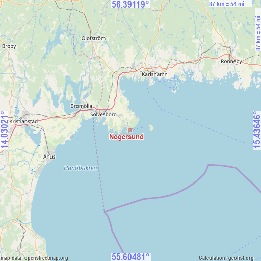
Nogersund GPS coordinates[2]
56° 0' 0" North, 14° 43' 59.988" East
| Map corner | latitude | longitude |
|---|---|---|
| Upper-left | 56.39119°, | 14.03021° |
| Center: | 56°, | 14.73333° |
| Lower-right: | 55.60481°, | 15.43646° |
| Map W x H: | 87.4×87.4 km | = 54.3×54.3mi |
| max Lat: | 67.85572° ⇑92.7% North |
| Nogersund: | 56° |
| min Lat: | ⇓7.3% South 55.34337° |
| min Long | Nogersund | max Long |
| 11.1712° | 14.73333° | 24.13676° |
| W 46%⇐ | ⇒54% E |
Elevation
Elevation of Nogersund is 12 m = 39 ft, and this is 70.6 m = 232 ft below average elevation for this country.
| Max E: |
663 m = 2175 ft | 85.7% |
| Avg. | 82.6 m = 271 ft | |
| Nogersund | 12 m = 39 ft | |
Min E: |
-1 m = -3 ft | 14.3% |
See also: Sweden elevation on elevation.city.
Geographical zone
Nogersund is located in North temperate zone (between Tropic of Cancer and the Arctic Circle). Distance of this North polar circle is 1174.6 km =729.9 mi to North.| Distance of | km | miles | from Nogersund |
|---|---|---|---|
| North Pole | 3780.4 | 2349 | to North |
| Arctic Circle | 1174.6 | 729.9 | to North |
| Tropic Cancer | 3620.7 | 2249.8 | to South |
| Equator | 6226.6 | 3869 | to South |


Nearby cities:
15 places around Nogersund: (largest is in red/bold)
• Bromölla
18.4 km =11.4 mi,  297°
297°
• Fjälkinge
28.9 km =18 mi,  279°
279°
• Gualöv
20.4 km =12.7 mi,  285°
285°
• Hällaryd
26 km =16.2 mi,  31°
31°
• Hällevik
2.8 km =1.7 mi,  311°
311°
• Hörvik
5 km =3.1 mi,  20°
20°
• Jämshög
29.2 km =18.1 mi,  332°
332°
• Karlshamn
20.6 km =12.8 mi, 22°
• Mjällby
6.4 km =4 mi, 330°
• Mörrum
21.5 km =13.4 mi,  2°
2°
• Norje
13.6 km =8.5 mi,  342°
342°
• Näsum
24.5 km =15.2 mi,  323°
323°
• Rinkaby
29.1 km =18.1 mi,  266°
266°
• Sölvesborg
11.4 km =7.1 mi, 300°
• Valje
13.7 km =8.5 mi, 300°
Sources, notices
• [Note1] Compared only with cities in Sweden existing in our database
• [Src1] Map data: © OpenStreetMap contributors (CC-BY-SA)
• [Src2] Other city data from geonames.org with taken over terms of usage.
• [Src3] Geographical zone / Annual Mean Temperature by Robert A. Rohde @ Wikipedia
