Mölnlycke geodata
Mölnlycke (Västra Götaland) is a seat of a second-order administrative division; located in Sweden in Europe/Stockholm (GMT+2) time zone. With population of 17,579 people, there are 89 cities with bigger population in this country. Compared to other cities in Sweden, 69% of cities are located further ↑North; 93.3% of cities are located further →East and 52.7% of cities have lower elevation than Mölnlycke. Note1


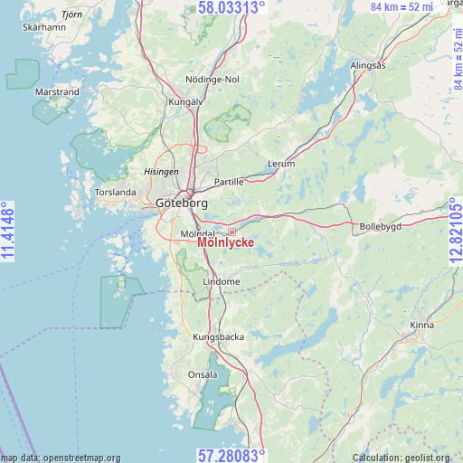
Mölnlycke GPS coordinates[2]
57° 39' 32.148" North, 12° 7' 4.512" East
| Map corner | latitude | longitude |
|---|---|---|
| Upper-left | 58.03313°, | 11.4148° |
| Center: | 57.65893°, | 12.11792° |
| Lower-right: | 57.28083°, | 12.82105° |
| Map W x H: | 83.6×83.6 km | = 51.9×51.9mi |
| max Lat: | 67.85572° ⇑69% North |
| Mölnlycke: | 57.65893° |
| min Lat: | ⇓31% South 55.34337° |
| min Long | Mölnlycke | max Long |
| 11.1712° | 12.11792° | 24.13676° |
| W 6.7%⇐ | ⇒93.3% E |
Elevation
Elevation of Mölnlycke is 55 m = 180 ft, and this is 27.6 m = 91 ft below average elevation for this country.
| Max E: |
663 m = 2175 ft | 47.3% |
| Avg. | 82.6 m = 271 ft | |
| Mölnlycke | 55 m = 180 ft | |
Min E: |
-1 m = -3 ft | 52.7% |
See also: Sweden elevation on elevation.city.
Geographical zone
Mölnlycke is located in North temperate zone (between Tropic of Cancer and the Arctic Circle). Distance of this North polar circle is 990.1 km =615.2 mi to North.| Distance of | km | miles | from Mölnlycke |
|---|---|---|---|
| North Pole | 3596 | 2234.5 | to North |
| Arctic Circle | 990.1 | 615.2 | to North |
| Tropic Cancer | 3805.2 | 2364.4 | to South |
| Equator | 6411.1 | 3983.7 | to South |


Nearby cities:
15 places around Mölnlycke: (largest is in red/bold)
• Angered
14.2 km =8.8 mi,  355°
355°
• Eriksbo
13.3 km =8.3 mi,  340°
340°
• Furulund
6.5 km =4 mi,  8°
8°
• Göteborg
10.5 km =6.5 mi,  300°
300°
• Jonsered
10.2 km =6.3 mi,  18°
18°
• Kåhög
10.4 km =6.5 mi, 11°
• Kållered
6.7 km =4.2 mi,  216°
216°
• Landvetter
6.4 km =4 mi,  61°
61°
• Lindome
10.5 km =6.5 mi,  191°
191°
• Majorna
12.6 km =7.8 mi,  287°
287°
• Mölndal
6.2 km =3.9 mi,  266°
266°
• Partille
9 km =5.6 mi, 355°
• Västra Frölunda
11.3 km =7 mi,  263°
263°
• Öjersjö
4.5 km =2.8 mi, 12°
• Öxeryd
12.9 km =8 mi,  48°
48°
Sources, notices
• [Note1] Compared only with cities in Sweden existing in our database
• [Src1] Map data: © OpenStreetMap contributors (CC-BY-SA)
• [Src2] Other city data from geonames.org with taken over terms of usage.
• [Src3] Geographical zone / Annual Mean Temperature by Robert A. Rohde @ Wikipedia
