Edinburgh of the Seven Seas geodata
Edinburgh of the Seven Seas (Tristan da Cunha) is a seat of a first-order administrative division; located in Saint Helena in Atlantic/St_Helena (GMT+0) time zone. With population of 271 people, there are 4 cities with bigger population in this country. Compared to other cities in Saint Helena, 100% of cities are located further ↑North; 75% of cities are located further →East and 75% of cities have higher elevation than Edinburgh of the Seven Seas. Note1
Current local time in Edinburgh of the Seven Seas:
11:32 AM, WednesdayDifference from your time zone: hours


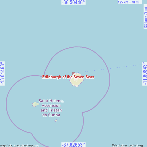
Edinburgh of the Seven Seas GPS coordinates[2]
37° 4' 3.252" South, 12° 18' 41.58" West
| Map corner | latitude | longitude |
|---|---|---|
| Upper-left | -36.50446°, | -13.01468° |
| Center: | -37.06757°, | -12.31155° |
| Lower-right: | -37.62653°, | -11.60843° |
| Map W x H: | 124.8×124.8 km | = 77.5×77.5mi |
| max Lat: | -7.92861° ⇑100% North |
| Edinburgh of the Seven Seas: | -37.06757° |
| min Lat: | ⇓0% South -37.06757° |
| min Long | Edinburgh of th | max Long |
| -14.41194° | -12.31155° | -5.68571° |
| W 25%⇐ | ⇒75% E |
Elevation
Elevation of Edinburgh of the Seven Seas is 42 m = 138 ft, and this is 233 m = 764 ft below average elevation for this country.
| Max E: |
526 m = 1726 ft | 75% |
| Avg. | 275 m = 902 ft | |
| Edinburgh of the Seven Seas | 42 m = 138 ft | |
Min E: |
20 m = 66 ft | 25% |
See also: Saint Helena elevation on elevation.city.
Geographical zone
Edinburgh of the Seven Seas is located in South temperate zone (between Tropic of Capricorn and the Antarctic Circle). Distance of this Southern Tropic circle is 1515.6 km =941.7 mi to North.| Distance of | km | miles | from Edinburgh of the Seven Seas |
|---|---|---|---|
| Equator | 4121.5 | 2561 | to North |
| Tropic Capricorn | 1515.6 | 941.7 | to North |
| Antarctic Circle | 3279.6 | 2037.8 | to South |
| South Pole | 5885.5 | 3657.1 | to South |


Nearby cities:
4 places around Edinburgh of the Seven Seas: (largest is in red/bold)
• Georgetown
3246.9 km =2017.5 mi,  356°
356°
• Half Tree Hollow
2437.5 km =1514.6 mi,  15°
15°
• Jamestown
2437.5 km =1514.6 mi, 15°
• Longwood
2437.1 km =1514.3 mi, 15°
Sources, notices
• [Note1] Compared only with cities in Saint Helena existing in our database
• [Src1] Map data: © OpenStreetMap contributors (CC-BY-SA)
• [Src2] Other city data from geonames.org with taken over terms of usage.
• [Src3] Geographical zone / Annual Mean Temperature by Robert A. Rohde @ Wikipedia
