Ižakovci geodata
Ižakovci (Beltinci) is a populated place; located in Slovenia in Europe/Ljubljana (GMT+2) time zone. With population of 827 people, there are 282 cities with bigger population in this country. Compared to other cities in Slovenia, 90.3% of cities are located further ↓South; 94.7% of cities are located further ←West and 83.2% of cities have higher elevation than Ižakovci. Note1


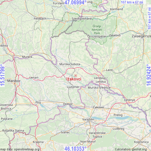
Ižakovci GPS coordinates[2]
46° 35' 20.004" North, 16° 13' 15.996" East
| Map corner | latitude | longitude |
|---|---|---|
| Upper-left | 47.06994°, | 15.51799° |
| Center: | 46.58889°, | 16.22111° |
| Lower-right: | 46.10353°, | 16.92424° |
| Map W x H: | 107.5×107.5 km | = 66.8×66.8mi |
| max Lat: | 46.83694° ⇑9.7% North |
| Ižakovci: | 46.58889° |
| min Lat: | ⇓90.3% South 45.47667° |
| min Long | Ižakovci | max Long |
| 13.52639° | 16.22111° | 16.4975° |
| W 94.7%⇐ | ⇒5.3% E |
Elevation
Elevation of Ižakovci is 186 m = 610 ft, and this is 139.6 m = 458 ft below average elevation for this country.
| Max E: |
1551 m = 5089 ft | 83.2% |
| Avg. | 325.6 m = 1068 ft | |
| Ižakovci | 186 m = 610 ft | |
Min E: |
2 m = 7 ft | 16.8% |
See also: Slovenia elevation on elevation.city.
Geographical zone
Ižakovci is located in North temperate zone (between Tropic of Cancer and the Arctic Circle). Distance of this North polar circle is 2221 km =1380.1 mi to North.| Distance of | km | miles | from Ižakovci |
|---|---|---|---|
| North Pole | 4826.9 | 2999.3 | to North |
| Arctic Circle | 2221 | 1380.1 | to North |
| Tropic Cancer | 2574.3 | 1599.6 | to South |
| Equator | 5180.2 | 3218.8 | to South |


Nearby cities:
15 places around Ižakovci: (largest is in red/bold)
• Bakovci
6.4 km =4 mi,  301°
301°
• Beltinci
2.4 km =1.5 mi,  39°
39°
• Bratonci
3.2 km =2 mi,  357°
357°
• Cven
4.6 km =2.9 mi,  181°
181°
• Dokležovje
3.7 km =2.3 mi, 296°
• Gančani
5.4 km =3.4 mi,  25°
25°
• Gomilica
7.1 km =4.4 mi,  76°
76°
• Gornja Bistrica
4.3 km =2.7 mi,  125°
125°
• Križevci pri Ljutomeru
6.7 km =4.2 mi,  250°
250°
• Lipa
5.5 km =3.4 mi,  68°
68°
• Lipovci
4.4 km =2.7 mi,  6°
6°
• Melinci
2.1 km =1.3 mi,  145°
145°
• Odranci
4.5 km =2.8 mi,  93°
93°
• Trnje
6.7 km =4.2 mi, 91°
• Veržej
4.3 km =2.7 mi,  262°
262°
Sources, notices
• [Note1] Compared only with cities in Slovenia existing in our database
• [Src1] Map data: © OpenStreetMap contributors (CC-BY-SA)
• [Src2] Other city data from geonames.org with taken over terms of usage.
• [Src3] Geographical zone / Annual Mean Temperature by Robert A. Rohde @ Wikipedia
