Sv. Trojica v Slov. Goricah geodata
Sv. Trojica v Slov. Goricah is a seat of a first-order administrative division; located in Slovenia in Europe/Ljubljana (GMT+2) time zone. With population of 730 people, there are 342 cities with bigger population in this country. Compared to other cities in Slovenia, 89% of cities are located further ↓South; 85.5% of cities are located further ←West and 60% of cities have higher elevation than Sv. Trojica v Slov. Goricah. Note1
Current local time in Sv. Trojica v Slov. Goricah:
06:27 AM, MondayDifference from your time zone: hours


Sv. Trojica v Slov. Goricah GPS coordinates[2]
46° 34' 36.012" North, 15° 52' 36.984" East
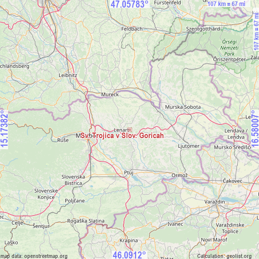
| Map corner | latitude | longitude |
|---|---|---|
| Upper-left | 47.05783°, | 15.17382° |
| Center: | 46.57667°, | 15.87694° |
| Lower-right: | 46.0912°, | 16.58007° |
| Map W x H: | 107.5×107.5 km | = 66.8×66.8mi |
| max Lat: | 46.83694° ⇑11% North |
| Sv. Trojica v Slov. Goricah: | 46.57667° |
| min Lat: | ⇓89% South 45.47667° |
| min Long | Sv. Trojica v S | max Long |
| 13.52639° | 15.87694° | 16.4975° |
| W 85.5%⇐ | ⇒14.5% E |
Elevation
Elevation of Sv. Trojica v Slov. Goricah is 272 m = 892 ft, and this is 53.6 m = 176 ft below average elevation for this country.
| Max E: |
1551 m = 5089 ft | 60% |
| Avg. | 325.6 m = 1068 ft | |
| Sv. Trojica v Slov. Goricah | 272 m = 892 ft | |
Min E: |
2 m = 7 ft | 40% |
See also: Slovenia elevation on elevation.city.
Geographical zone
Sv. Trojica v Slov. Goricah is located in North temperate zone (between Tropic of Cancer and the Arctic Circle). Distance of this North polar circle is 2222.3 km =1380.9 mi to North.| Distance of | km | miles | from Sv. Trojica v Slov. Goricah |
|---|---|---|---|
| North Pole | 4828.2 | 3000.1 | to North |
| Arctic Circle | 2222.3 | 1380.9 | to North |
| Tropic Cancer | 2572.9 | 1598.7 | to South |
| Equator | 5178.8 | 3218 | to South |


Nearby cities:
15 places around Sv. Trojica v Slov. Goricah: (largest is in red/bold)
• Benedikt
3.7 km =2.3 mi,  13°
13°
• Cerkvenjak
5.1 km =3.2 mi,  97°
97°
• Destrnik
9.4 km =5.8 mi,  179°
179°
• Hrastovec v Slov. Goricah
6.9 km =4.3 mi,  258°
258°
• Jurovski Dol
7.8 km =4.8 mi,  295°
295°
• Lenart v Slov. Goricah
3.5 km =2.2 mi,  268°
268°
• Spodnja Voličina
5.9 km =3.7 mi,  232°
232°
• Sv. Ana v Slov. Goricah
8.4 km =5.2 mi,  342°
342°
• Sveti Jurij ob Ščavnici
11.2 km =7 mi,  94°
94°
• Trnovska Vas
6.3 km =3.9 mi,  173°
173°
• Vitomarci
7.3 km =4.5 mi,  138°
138°
• Zgornja Voličina
8.6 km =5.3 mi,  236°
236°
• Zgornja Ščavnica
9.4 km =5.8 mi, 343°
• Zgornje Partinje
9.3 km =5.8 mi,  283°
283°
• Zimica
10.8 km =6.7 mi, 243°
Sources, notices
• [Note1] Compared only with cities in Slovenia existing in our database
• [Src1] Map data: © OpenStreetMap contributors (CC-BY-SA)
• [Src2] Other city data from geonames.org with taken over terms of usage.
• [Src3] Geographical zone / Annual Mean Temperature by Robert A. Rohde @ Wikipedia
