Trnovska Vas geodata
Trnovska Vas is a seat of a first-order administrative division; located in Slovenia in Europe/Ljubljana (GMT+2) time zone. With population of 367 people, there are 575 cities with bigger population in this country. Compared to other cities in Slovenia, 80.2% of cities are located further ↓South; 86.2% of cities are located further ←West and 68% of cities have higher elevation than Trnovska Vas. Note1


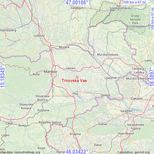
Trnovska Vas GPS coordinates[2]
46° 31' 12.684" North, 15° 53' 11.652" East
| Map corner | latitude | longitude |
|---|---|---|
| Upper-left | 47.00186°, | 15.18345° |
| Center: | 46.52019°, | 15.88657° |
| Lower-right: | 46.03422°, | 16.5897° |
| Map W x H: | 107.6×107.6 km | = 66.9×66.9mi |
| max Lat: | 46.83694° ⇑19.8% North |
| Trnovska Vas: | 46.52019° |
| min Lat: | ⇓80.2% South 45.47667° |
| min Long | Trnovska Vas | max Long |
| 13.52639° | 15.88657° | 16.4975° |
| W 86.2%⇐ | ⇒13.8% E |
Elevation
Elevation of Trnovska Vas is 247 m = 810 ft, and this is 78.6 m = 258 ft below average elevation for this country.
| Max E: |
1551 m = 5089 ft | 68% |
| Avg. | 325.6 m = 1068 ft | |
| Trnovska Vas | 247 m = 810 ft | |
Min E: |
2 m = 7 ft | 32% |
See also: Slovenia elevation on elevation.city.
Geographical zone
Trnovska Vas is located in North temperate zone (between Tropic of Cancer and the Arctic Circle). Distance of this North polar circle is 2228.6 km =1384.8 mi to North.| Distance of | km | miles | from Trnovska Vas |
|---|---|---|---|
| North Pole | 4834.5 | 3004 | to North |
| Arctic Circle | 2228.6 | 1384.8 | to North |
| Tropic Cancer | 2566.6 | 1594.8 | to South |
| Equator | 5172.6 | 3214.1 | to South |


Nearby cities:
15 places around Trnovska Vas: (largest is in red/bold)
• Benedikt
9.8 km =6.1 mi,  0°
0°
• Cerkvenjak
7.1 km =4.4 mi,  37°
37°
• Destrnik
3.1 km =1.9 mi,  190°
190°
• Grajenščak
6.7 km =4.2 mi,  232°
232°
• Hrastovec v Slov. Goricah
9 km =5.6 mi,  303°
303°
• Juršinci
7.6 km =4.7 mi,  121°
121°
• Kicar
7.8 km =4.8 mi,  165°
165°
• Krčevina pri Vurbergu
7.7 km =4.8 mi, 229°
• Lenart v Slov. Goricah
7.5 km =4.7 mi,  325°
325°
• Mestni Vrh
8.7 km =5.4 mi, 190°
• Podvinci
10 km =6.2 mi, 166°
• Spodnja Voličina
6.1 km =3.8 mi, 296°
• Sv. Trojica v Slov. Goricah
6.3 km =3.9 mi,  353°
353°
• Vitomarci
4.1 km =2.5 mi,  78°
78°
• Zgornja Voličina
8 km =5 mi,  280°
280°
Sources, notices
• [Note1] Compared only with cities in Slovenia existing in our database
• [Src1] Map data: © OpenStreetMap contributors (CC-BY-SA)
• [Src2] Other city data from geonames.org with taken over terms of usage.
• [Src3] Geographical zone / Annual Mean Temperature by Robert A. Rohde @ Wikipedia
