Koyunluca geodata
Koyunluca (Şanlıurfa) is a populated place; located in Turkey in Europe/Istanbul (GMT+3) time zone. With population of 1,028 people, there are 1083 cities with bigger population in this country. Compared to other cities in Turkey, 92.7% of cities are located further ↑North; 70.2% of cities are located further ←West and 60.9% of cities have higher elevation than Koyunluca. Note1


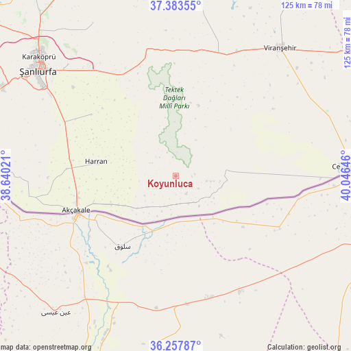
Koyunluca GPS coordinates[2]
36° 49' 22.008" North, 39° 20' 35.988" East
| Map corner | latitude | longitude |
|---|---|---|
| Upper-left | 37.38355°, | 38.64021° |
| Center: | 36.82278°, | 39.34333° |
| Lower-right: | 36.25787°, | 40.04646° |
| Map W x H: | 125.2×125.2 km | = 77.8×77.8mi |
| max Lat: | 42.02683° ⇑92.7% North |
| Koyunluca: | 36.82278° |
| min Lat: | ⇓7.3% South 35.9025° |
| min Long | Koyunluca | max Long |
| 25.90902° | 39.34333° | 44.60099° |
| W 70.2%⇐ | ⇒29.8% E |
Elevation
Elevation of Koyunluca is 494 m = 1621 ft, and this is 223.4 m = 733 ft below average elevation for this country.
| Max E: |
2682 m = 8799 ft | 60.9% |
| Avg. | 717.4 m = 2354 ft | |
| Koyunluca | 494 m = 1621 ft | |
Min E: |
0 m = 0 ft | 39.1% |
See also: Turkey elevation on elevation.city.
Geographical zone
Koyunluca is located in North temperate zone (between Tropic of Cancer and the Arctic Circle). Distance of this Northern Tropic circle is 1488.4 km =924.8 mi to South.| Distance of | km | miles | from Koyunluca |
|---|---|---|---|
| North Pole | 5912.8 | 3674 | to North |
| Arctic Circle | 3306.9 | 2054.8 | to North |
| Tropic Cancer | 1488.4 | 924.8 | to South |
| Equator | 4094.3 | 2544.1 | to South |


Nearby cities:
15 places around Koyunluca: (largest is in red/bold)
• Akdiken
11.3 km =7 mi,  195°
195°
• Bulutlu
10.7 km =6.6 mi,  155°
155°
• Büyük Tokaç
15.7 km =9.8 mi,  119°
119°
• Büyük Çaylı
18.1 km =11.2 mi,  83°
83°
• Büyükyıldız
16.8 km =10.4 mi,  101°
101°
• Damlasu
9.2 km =5.7 mi, 117°
• Demirli
10 km =6.2 mi,  179°
179°
• Kepezli
17.9 km =11.1 mi,  206°
206°
• Meydankapı
17.1 km =10.6 mi,  254°
254°
• Pekmezli
12.2 km =7.6 mi,  128°
128°
• Saide
7.3 km =4.5 mi, 126°
• Yarımtepe
13.5 km =8.4 mi, 200°
• Yolbaşı
15.8 km =9.8 mi,  48°
48°
• Örenlı
18.1 km =11.2 mi,  341°
341°
• Şuayıpşehri
5.9 km =3.7 mi,  31°
31°
Sources, notices
• [Note1] Compared only with cities in Turkey existing in our database
• [Src1] Map data: © OpenStreetMap contributors (CC-BY-SA)
• [Src2] Other city data from geonames.org with taken over terms of usage.
• [Src3] Geographical zone / Annual Mean Temperature by Robert A. Rohde @ Wikipedia
