Örenlı geodata
Örenlı (Şanlıurfa) is a populated place; located in Turkey in Europe/Istanbul (GMT+3) time zone. With population of 563 people, there are 1277 cities with bigger population in this country. Compared to other cities in Turkey, 88.5% of cities are located further ↑North; 69.6% of cities are located further ←West and 53.9% of cities have higher elevation than Örenlı. Note1


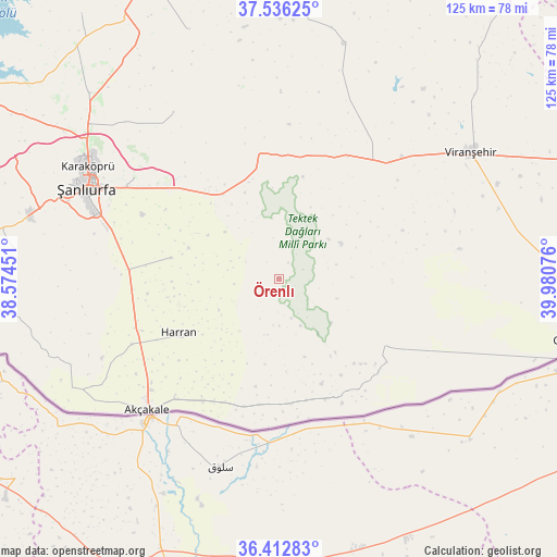
Örenlı GPS coordinates[2]
36° 58' 35.796" North, 39° 16' 39.468" East
| Map corner | latitude | longitude |
|---|---|---|
| Upper-left | 37.53625°, | 38.57451° |
| Center: | 36.97661°, | 39.27763° |
| Lower-right: | 36.41283°, | 39.98076° |
| Map W x H: | 124.9×124.9 km | = 77.6×77.6mi |
| max Lat: | 42.02683° ⇑88.5% North |
| Örenlı: | 36.97661° |
| min Lat: | ⇓11.5% South 35.9025° |
| min Long | Örenlı | max Long |
| 25.90902° | 39.27763° | 44.60099° |
| W 69.6%⇐ | ⇒30.4% E |
Elevation
Elevation of Örenlı is 611 m = 2005 ft, and this is 106.4 m = 349 ft below average elevation for this country.
| Max E: |
2682 m = 8799 ft | 53.9% |
| Avg. | 717.4 m = 2354 ft | |
| Örenlı | 611 m = 2005 ft | |
Min E: |
0 m = 0 ft | 46.1% |
See also: Turkey elevation on elevation.city.
Geographical zone
Örenlı is located in North temperate zone (between Tropic of Cancer and the Arctic Circle). Distance of this Northern Tropic circle is 1505.5 km =935.5 mi to South.| Distance of | km | miles | from Örenlı |
|---|---|---|---|
| North Pole | 5895.6 | 3663.4 | to North |
| Arctic Circle | 3289.8 | 2044.2 | to North |
| Tropic Cancer | 1505.5 | 935.5 | to South |
| Equator | 4111.4 | 2554.7 | to South |


Nearby cities:
15 places around Örenlı: (largest is in red/bold)
• Damlasu
25.5 km =15.8 mi,  146°
146°
• Eskiharran
20 km =12.4 mi,  255°
255°
• Harran
25.4 km =15.8 mi,  239°
239°
• Keçikıran
26 km =16.2 mi,  267°
267°
• Koyunluca
18.1 km =11.2 mi,  161°
161°
• Meydankapı
24 km =14.9 mi,  206°
206°
• Minare
24.8 km =15.4 mi, 258°
• Saide
24.4 km =15.2 mi, 151°
• Seksenören
18 km =11.2 mi, 268°
• Selalmaz
22.4 km =13.9 mi, 214°
• Uluağaç
19.3 km =12 mi,  219°
219°
• Yardımcı
24.7 km =15.3 mi,  281°
281°
• Yağmurlu
5.9 km =3.7 mi,  67°
67°
• Yolbaşı
18.8 km =11.7 mi,  110°
110°
• Şuayıpşehri
15.1 km =9.4 mi,  143°
143°
Sources, notices
• [Note1] Compared only with cities in Turkey existing in our database
• [Src1] Map data: © OpenStreetMap contributors (CC-BY-SA)
• [Src2] Other city data from geonames.org with taken over terms of usage.
• [Src3] Geographical zone / Annual Mean Temperature by Robert A. Rohde @ Wikipedia
