Steele geodata
Steele (Alabama) is a populated place; located in United States in America/Chicago (GMT-5) time zone. With population of 1,078 people, there are 15797 cities with bigger population in this country. Compared to other cities in United States, 80.7% of cities are located further ↑North; 52.4% of cities are located further ←West and 55.5% of cities have higher elevation than Steele. Note1


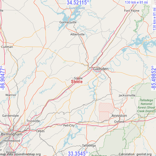
Steele GPS coordinates[2]
33° 56' 23.352" North, 86° 12' 5.904" West
| Map corner | latitude | longitude |
|---|---|---|
| Upper-left | 34.52115°, | -86.90477° |
| Center: | 33.93982°, | -86.20164° |
| Lower-right: | 33.3545°, | -85.49852° |
| Map W x H: | 129.7×129.7 km | = 80.6×80.6mi |
| max Lat: | 71.29058° ⇑80.7% North |
| Steele: | 33.93982° |
| min Lat: | ⇓19.3% South 19.06759° |
| min Long | Steele | max Long |
| -171.73463° | -86.20164° | -66.98998° |
| W 52.4%⇐ | ⇒47.6% E |
Elevation
Elevation of Steele is 178 m = 584 ft, and this is 116.8 m = 383 ft below average elevation for this country.
| Max E: |
3189 m = 10463 ft | 55.5% |
| Avg. | 294.8 m = 967 ft | |
| Steele | 178 m = 584 ft | |
Min E: |
-60 m = -197 ft | 44.5% |
See also: United States elevation on elevation.city.
Geographical zone
Steele is located in North temperate zone (between Tropic of Cancer and the Arctic Circle). Distance of this Northern Tropic circle is 1167.8 km =725.6 mi to South.| Distance of | km | miles | from Steele |
|---|---|---|---|
| North Pole | 6233.3 | 3873.2 | to North |
| Arctic Circle | 3627.4 | 2254 | to North |
| Tropic Cancer | 1167.8 | 725.6 | to South |
| Equator | 3773.8 | 2344.9 | to South |


Nearby cities:
15 places around Steele: (largest is in red/bold)
• Altoona
15 km =9.3 mi,  309°
309°
• Ashville
12.4 km =7.7 mi,  203°
203°
• Attalla
13.8 km =8.6 mi,  48°
48°
• Carlisle-Rockledge
20.7 km =12.9 mi,  20°
20°
• Egypt
15.5 km =9.6 mi, 15°
• Gadsden
19.8 km =12.3 mi,  65°
65°
• Gallant
7.7 km =4.8 mi,  328°
328°
• Glencoe
24.9 km =15.5 mi,  85°
85°
• Ivalee
11.7 km =7.3 mi,  26°
26°
• Oneonta
25 km =15.5 mi,  272°
272°
• Ragland
22.1 km =13.7 mi,  168°
168°
• Rainbow City
14.8 km =9.2 mi,  83°
83°
• Reece City
21.4 km =13.3 mi, 46°
• Southside
16.6 km =10.3 mi,  95°
95°
• Walnut Grove
17 km =10.6 mi, 325°
Sources, notices
• [Note1] Compared only with cities in United States existing in our database
• [Src1] Map data: © OpenStreetMap contributors (CC-BY-SA)
• [Src2] Other city data from geonames.org with taken over terms of usage.
• [Src3] Geographical zone / Annual Mean Temperature by Robert A. Rohde @ Wikipedia
