Harbour Heights geodata
Harbour Heights (Florida) is a populated place; located in United States in America/New_York (GMT-4) time zone. With population of 2,987 people, there are 9659 cities with bigger population in this country. Compared to other cities in United States, 97.6% of cities are located further ↑North; 65.5% of cities are located further ←West and 99.1% of cities have higher elevation than Harbour Heights. Note1


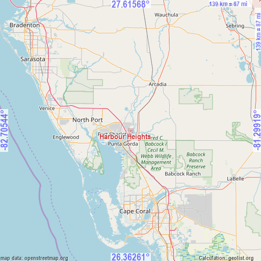
Harbour Heights GPS coordinates[2]
26° 59' 27.204" North, 82° 0' 8.316" West
| Map corner | latitude | longitude |
|---|---|---|
| Upper-left | 27.61568°, | -82.70544° |
| Center: | 26.99089°, | -82.00231° |
| Lower-right: | 26.36261°, | -81.29919° |
| Map W x H: | 139.3×139.3 km | = 86.6×86.6mi |
| max Lat: | 71.29058° ⇑97.6% North |
| Harbour Heights: | 26.99089° |
| min Lat: | ⇓2.4% South 19.06759° |
| min Long | Harbour Heights | max Long |
| -171.73463° | -82.00231° | -66.98998° |
| W 65.5%⇐ | ⇒34.5% E |
Elevation
Elevation of Harbour Heights is 3 m = 10 ft, and this is 291.8 m = 957 ft below average elevation for this country.
| Max E: |
3189 m = 10463 ft | 99.1% |
| Avg. | 294.8 m = 967 ft | |
| Harbour Heights | 3 m = 10 ft | |
Min E: |
-60 m = -197 ft | 0.9% |
See also: United States elevation on elevation.city.
Geographical zone
Harbour Heights is located in North temperate zone (between Tropic of Cancer and the Arctic Circle). Distance of this Northern Tropic circle is 395.2 km =245.6 mi to South.| Distance of | km | miles | from Harbour Heights |
|---|---|---|---|
| North Pole | 7006 | 4353.3 | to North |
| Arctic Circle | 4400.1 | 2734.1 | to North |
| Tropic Cancer | 395.2 | 245.6 | to South |
| Equator | 3001.1 | 1864.8 | to South |


Nearby cities:
15 places around Harbour Heights: (largest is in red/bold)
• Arcadia
28.8 km =17.9 mi,  29°
29°
• Burnt Store Marina
25.6 km =15.9 mi,  190°
190°
• Charlotte Harbor
7.4 km =4.6 mi,  240°
240°
• Charlotte Park
10.3 km =6.4 mi,  209°
209°
• Cleveland
3.7 km =2.3 mi,  150°
150°
• Grove City
33.3 km =20.7 mi,  255°
255°
• Nocatee
22.3 km =13.9 mi, 32°
• North Port
23.9 km =14.9 mi,  284°
284°
• Port Charlotte
8.9 km =5.5 mi, 259°
• Punta Gorda
8 km =5 mi, 212°
• Punta Gorda Isles
11.1 km =6.9 mi,  222°
222°
• Rotonda West
30.9 km =19.2 mi,  247°
247°
• Solana
5.4 km =3.4 mi, 205°
• Southeast Arcadia
26.3 km =16.3 mi, 34°
• Warm Mineral Springs
26.7 km =16.6 mi,  286°
286°
Sources, notices
• [Note1] Compared only with cities in United States existing in our database
• [Src1] Map data: © OpenStreetMap contributors (CC-BY-SA)
• [Src2] Other city data from geonames.org with taken over terms of usage.
• [Src3] Geographical zone / Annual Mean Temperature by Robert A. Rohde @ Wikipedia
