Punta Gorda geodata
Punta Gorda (Florida) is a seat of a second-order administrative division; located in United States in America/New_York (GMT-4) time zone. With population of 18,150 people, there are 2766 cities with bigger population in this country. Compared to other cities in United States, 97.6% of cities are located further ↑North; 65.4% of cities are located further ←West and 99.4% of cities have higher elevation than Punta Gorda. Note1


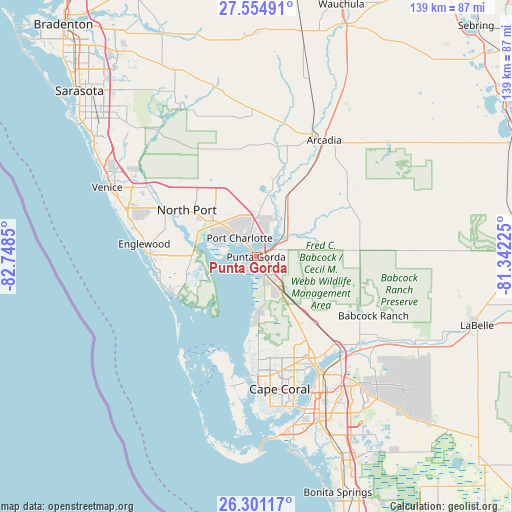
Punta Gorda GPS coordinates[2]
26° 55' 47.208" North, 82° 2' 43.332" West
| Map corner | latitude | longitude |
|---|---|---|
| Upper-left | 27.55491°, | -82.7485° |
| Center: | 26.92978°, | -82.04537° |
| Lower-right: | 26.30117°, | -81.34225° |
| Map W x H: | 139.4×139.4 km | = 86.6×86.6mi |
| max Lat: | 71.29058° ⇑97.6% North |
| Punta Gorda: | 26.92978° |
| min Lat: | ⇓2.4% South 19.06759° |
| min Long | Punta Gorda | max Long |
| -171.73463° | -82.04537° | -66.98998° |
| W 65.4%⇐ | ⇒34.6% E |
Elevation
Elevation of Punta Gorda is 2 m = 7 ft, and this is 292.8 m = 961 ft below average elevation for this country.
| Max E: |
3189 m = 10463 ft | 99.4% |
| Avg. | 294.8 m = 967 ft | |
| Punta Gorda | 2 m = 7 ft | |
Min E: |
-60 m = -197 ft | 0.6% |
See also: United States elevation on elevation.city.
Geographical zone
Punta Gorda is located in North temperate zone (between Tropic of Cancer and the Arctic Circle). Distance of this Northern Tropic circle is 388.4 km =241.3 mi to South.| Distance of | km | miles | from Punta Gorda |
|---|---|---|---|
| North Pole | 7012.8 | 4357.6 | to North |
| Arctic Circle | 4406.9 | 2738.3 | to North |
| Tropic Cancer | 388.4 | 241.3 | to South |
| Equator | 2994.3 | 1860.6 | to South |


Nearby cities:
15 places around Punta Gorda: (largest is in red/bold)
• Bokeelia
27.4 km =17 mi,  204°
204°
• Burnt Store Marina
18.3 km =11.4 mi,  181°
181°
• Charlotte Harbor
3.8 km =2.4 mi,  325°
325°
• Charlotte Park
2.4 km =1.5 mi, 201°
• Cleveland
7 km =4.3 mi,  59°
59°
• Grove City
28 km =17.4 mi,  266°
266°
• Harbour Heights
8 km =5 mi,  32°
32°
• Nocatee
30.3 km =18.8 mi, 32°
• North Port
22.8 km =14.2 mi,  303°
303°
• Port Charlotte
6.8 km =4.2 mi,  318°
318°
• Punta Gorda Isles
3.5 km =2.2 mi,  247°
247°
• Rotonda West
24.8 km =15.4 mi,  258°
258°
• Solana
2.7 km =1.7 mi,  45°
45°
• Suncoast Estates
29.9 km =18.6 mi,  144°
144°
• Warm Mineral Springs
25.7 km =16 mi, 304°
Sources, notices
• [Note1] Compared only with cities in United States existing in our database
• [Src1] Map data: © OpenStreetMap contributors (CC-BY-SA)
• [Src2] Other city data from geonames.org with taken over terms of usage.
• [Src3] Geographical zone / Annual Mean Temperature by Robert A. Rohde @ Wikipedia
