Mexico Beach geodata
Mexico Beach (Florida) is a populated place; located in United States in America/Chicago (GMT-5) time zone. With population of 1,167 people, there are 15300 cities with bigger population in this country. Compared to other cities in United States, 93.6% of cities are located further ↑North; 54.8% of cities are located further ←West and 97.4% of cities have higher elevation than Mexico Beach. Note1


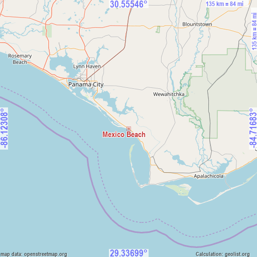
Mexico Beach GPS coordinates[2]
29° 56' 53.124" North, 85° 25' 11.82" West
| Map corner | latitude | longitude |
|---|---|---|
| Upper-left | 30.55546°, | -86.12308° |
| Center: | 29.94809°, | -85.41995° |
| Lower-right: | 29.33699°, | -84.71683° |
| Map W x H: | 135.5×135.5 km | = 84.2×84.2mi |
| max Lat: | 71.29058° ⇑93.6% North |
| Mexico Beach: | 29.94809° |
| min Lat: | ⇓6.4% South 19.06759° |
| min Long | Mexico Beach | max Long |
| -171.73463° | -85.41995° | -66.98998° |
| W 54.8%⇐ | ⇒45.2% E |
Elevation
Elevation of Mexico Beach is 6 m = 20 ft, and this is 288.8 m = 948 ft below average elevation for this country.
| Max E: |
3189 m = 10463 ft | 97.4% |
| Avg. | 294.8 m = 967 ft | |
| Mexico Beach | 6 m = 20 ft | |
Min E: |
-60 m = -197 ft | 2.6% |
See also: United States elevation on elevation.city.
Geographical zone
Mexico Beach is located in North temperate zone (between Tropic of Cancer and the Arctic Circle). Distance of this Northern Tropic circle is 724 km =449.9 mi to South.| Distance of | km | miles | from Mexico Beach |
|---|---|---|---|
| North Pole | 6677.1 | 4149 | to North |
| Arctic Circle | 4071.3 | 2529.8 | to North |
| Tropic Cancer | 724 | 449.9 | to South |
| Equator | 3329.9 | 2069.1 | to South |


Nearby cities:
15 places around Mexico Beach: (largest is in red/bold)
• Callaway
27 km =16.8 mi,  327°
327°
• Cedar Grove
31.7 km =19.7 mi,  321°
321°
• Hiland Park
34.5 km =21.4 mi, 324°
• Lower Grand Lagoon
38.6 km =24 mi,  304°
304°
• Lynn Haven
39.7 km =24.7 mi, 326°
• Panama City
32.9 km =20.4 mi, 315°
• Panama City Beach
45 km =28 mi, 304°
• Parker
26.9 km =16.7 mi, 319°
• Port Saint Joe
18.9 km =11.7 mi,  143°
143°
• Pretty Bayou
38.4 km =23.9 mi, 316°
• Springfield
29.3 km =18.2 mi, 321°
• Tyndall Air Force Base
23.6 km =14.7 mi,  310°
310°
• Upper Grand Lagoon
39.1 km =24.3 mi, 307°
• Wewahitchka
28 km =17.4 mi,  49°
49°
• Youngstown
46.3 km =28.8 mi,  357°
357°
Sources, notices
• [Note1] Compared only with cities in United States existing in our database
• [Src1] Map data: © OpenStreetMap contributors (CC-BY-SA)
• [Src2] Other city data from geonames.org with taken over terms of usage.
• [Src3] Geographical zone / Annual Mean Temperature by Robert A. Rohde @ Wikipedia
