Chamblee geodata
Chamblee (Georgia) is a populated place; located in United States in America/New_York (GMT-4) time zone. With population of 28,244 people, there are 1763 cities with bigger population in this country. Compared to other cities in United States, 81% of cities are located further ↑North; 58.3% of cities are located further ←West and 74.7% of cities have lower elevation than Chamblee. Note1


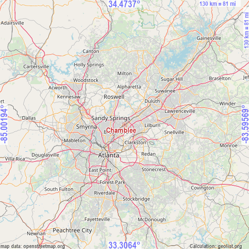
Chamblee GPS coordinates[2]
33° 53' 31.38" North, 84° 17' 55.716" West
| Map corner | latitude | longitude |
|---|---|---|
| Upper-left | 34.4737°, | -85.00194° |
| Center: | 33.89205°, | -84.29881° |
| Lower-right: | 33.3064°, | -83.59569° |
| Map W x H: | 129.8×129.8 km | = 80.7×80.7mi |
| max Lat: | 71.29058° ⇑81% North |
| Chamblee: | 33.89205° |
| min Lat: | ⇓19% South 19.06759° |
| min Long | Chamblee | max Long |
| -171.73463° | -84.29881° | -66.98998° |
| W 58.3%⇐ | ⇒41.7% E |
Elevation
Elevation of Chamblee is 311 m = 1020 ft, and this is 16.2 m = 53 ft above average elevation for this country.
| Max E: |
3189 m = 10463 ft | 25.3% |
| Chamblee | 311 m 1020 ft | |
| Avg. | 294.8 m = 967 ft | |
Min E: |
-60 m = -197 ft | 74.7% |
See also: United States elevation on elevation.city.
Geographical zone
Chamblee is located in North temperate zone (between Tropic of Cancer and the Arctic Circle). Distance of this Northern Tropic circle is 1162.5 km =722.3 mi to South.| Distance of | km | miles | from Chamblee |
|---|---|---|---|
| North Pole | 6238.6 | 3876.5 | to North |
| Arctic Circle | 3632.7 | 2257.3 | to North |
| Tropic Cancer | 1162.5 | 722.3 | to South |
| Equator | 3768.4 | 2341.6 | to South |


Nearby cities:
15 places around Chamblee: (largest is in red/bold)
• Avondale Estates
13.7 km =8.5 mi,  167°
167°
• Brookhaven
5.3 km =3.3 mi,  225°
225°
• Clarkston
10.7 km =6.6 mi,  149°
149°
• Decatur
13 km =8.1 mi,  178°
178°
• Doraville
1.6 km =1 mi,  64°
64°
• Druid Hills
12.9 km =8 mi,  195°
195°
• Dunwoody
6.9 km =4.3 mi,  331°
331°
• Norcross
9.6 km =6 mi, 55°
• North Atlanta
4.6 km =2.9 mi, 229°
• North Decatur
11.3 km =7 mi, 183°
• North Druid Hills
8.5 km =5.3 mi,  189°
189°
• Peachtree Corners
11.2 km =7 mi,  39°
39°
• Sandy Springs
8.2 km =5.1 mi,  295°
295°
• Scottdale
11.8 km =7.3 mi,  164°
164°
• Tucker
8.6 km =5.3 mi,  118°
118°
Sources, notices
• [Note1] Compared only with cities in United States existing in our database
• [Src1] Map data: © OpenStreetMap contributors (CC-BY-SA)
• [Src2] Other city data from geonames.org with taken over terms of usage.
• [Src3] Geographical zone / Annual Mean Temperature by Robert A. Rohde @ Wikipedia
