Johnston City geodata
Johnston City (Illinois) is a populated place; located in United States in America/Chicago (GMT-5) time zone. With population of 3,500 people, there are 8852 cities with bigger population in this country. Compared to other cities in United States, 62.6% of cities are located further ↑North; 55.9% of cities are located further →East and 64% of cities have higher elevation than Johnston City. Note1


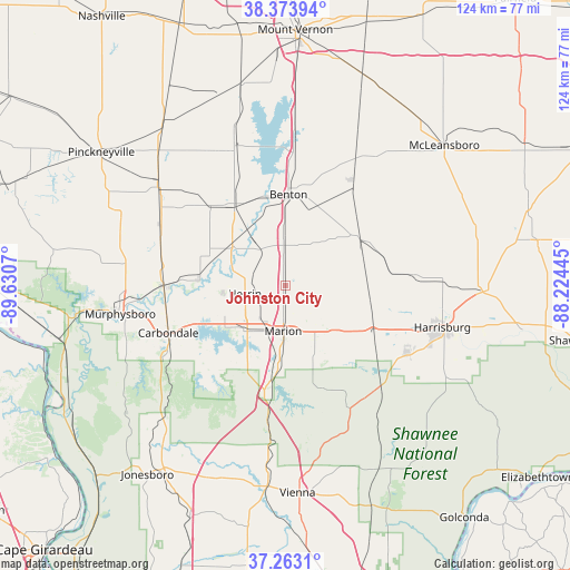
Johnston City GPS coordinates[2]
37° 49' 14.196" North, 88° 55' 39.252" West
| Map corner | latitude | longitude |
|---|---|---|
| Upper-left | 38.37394°, | -89.6307° |
| Center: | 37.82061°, | -88.92757° |
| Lower-right: | 37.2631°, | -88.22445° |
| Map W x H: | 123.5×123.5 km | = 76.7×76.7mi |
| max Lat: | 71.29058° ⇑62.6% North |
| Johnston City: | 37.82061° |
| min Lat: | ⇓37.4% South 19.06759° |
| min Long | Johnston City | max Long |
| -171.73463° | -88.92757° | -66.98998° |
| W 44.1%⇐ | ⇒55.9% E |
Elevation
Elevation of Johnston City is 133 m = 436 ft, and this is 161.8 m = 531 ft below average elevation for this country.
| Max E: |
3189 m = 10463 ft | 64% |
| Avg. | 294.8 m = 967 ft | |
| Johnston City | 133 m = 436 ft | |
Min E: |
-60 m = -197 ft | 36% |
See also: United States elevation on elevation.city.
Geographical zone
Johnston City is located in North temperate zone (between Tropic of Cancer and the Arctic Circle). Distance of this Northern Tropic circle is 1599.3 km =993.8 mi to South.| Distance of | km | miles | from Johnston City |
|---|---|---|---|
| North Pole | 5801.8 | 3605.1 | to North |
| Arctic Circle | 3195.9 | 1985.8 | to North |
| Tropic Cancer | 1599.3 | 993.8 | to South |
| Equator | 4205.3 | 2613.1 | to South |


Nearby cities:
15 places around Johnston City: (largest is in red/bold)
• Benton
19.6 km =12.2 mi,  1°
1°
• Cambria
17.4 km =10.8 mi,  255°
255°
• Carterville
14.8 km =9.2 mi,  242°
242°
• Christopher
20.2 km =12.6 mi,  326°
326°
• Crainville
14.5 km =9 mi, 238°
• Energy
10.1 km =6.3 mi, 239°
• Herrin
9 km =5.6 mi, 257°
• Hurst
19 km =11.8 mi,  274°
274°
• Marion
10 km =6.2 mi,  182°
182°
• Pittsburg
8.4 km =5.2 mi,  125°
125°
• Royalton
17.6 km =10.9 mi,  290°
290°
• Thompsonville
18.1 km =11.2 mi,  53°
53°
• West City
19.3 km =12 mi,  358°
358°
• West Frankfort
8.6 km =5.3 mi, 357°
• Zeigler
14 km =8.7 mi,  308°
308°
Sources, notices
• [Note1] Compared only with cities in United States existing in our database
• [Src1] Map data: © OpenStreetMap contributors (CC-BY-SA)
• [Src2] Other city data from geonames.org with taken over terms of usage.
• [Src3] Geographical zone / Annual Mean Temperature by Robert A. Rohde @ Wikipedia
