Grosse Tete geodata
Grosse Tete (Louisiana) is a populated place; located in United States in America/Chicago (GMT-5) time zone. With population of 631 people, there are 19346 cities with bigger population in this country. Compared to other cities in United States, 92.1% of cities are located further ↑North; 63% of cities are located further →East and 95.7% of cities have higher elevation than Grosse Tete. Note1


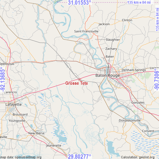
Grosse Tete GPS coordinates[2]
30° 24' 39.708" North, 91° 26' 1.392" West
| Map corner | latitude | longitude |
|---|---|---|
| Upper-left | 31.01553°, | -92.13685° |
| Center: | 30.41103°, | -91.43372° |
| Lower-right: | 29.80277°, | -90.7306° |
| Map W x H: | 134.8×134.8 km | = 83.8×83.8mi |
| max Lat: | 71.29058° ⇑92.1% North |
| Grosse Tete: | 30.41103° |
| min Lat: | ⇓7.9% South 19.06759° |
| min Long | Grosse Tete | max Long |
| -171.73463° | -91.43372° | -66.98998° |
| W 37%⇐ | ⇒63% E |
Elevation
Elevation of Grosse Tete is 8 m = 26 ft, and this is 286.8 m = 941 ft below average elevation for this country.
| Max E: |
3189 m = 10463 ft | 95.7% |
| Avg. | 294.8 m = 967 ft | |
| Grosse Tete | 8 m = 26 ft | |
Min E: |
-60 m = -197 ft | 4.3% |
See also: United States elevation on elevation.city.
Geographical zone
Grosse Tete is located in North temperate zone (between Tropic of Cancer and the Arctic Circle). Distance of this Northern Tropic circle is 775.5 km =481.9 mi to South.| Distance of | km | miles | from Grosse Tete |
|---|---|---|---|
| North Pole | 6625.7 | 4117 | to North |
| Arctic Circle | 4019.8 | 2497.8 | to North |
| Tropic Cancer | 775.5 | 481.9 | to South |
| Equator | 3381.4 | 2101.1 | to South |


Nearby cities:
15 places around Grosse Tete: (largest is in red/bold)
• Addis
17.4 km =10.8 mi,  111°
111°
• Baker
32.2 km =20 mi,  52°
52°
• Baton Rouge
23.9 km =14.9 mi,  81°
81°
• Brusly
17.4 km =10.8 mi,  96°
96°
• Crescent
23 km =14.3 mi,  142°
142°
• Erwinville
13.6 km =8.5 mi,  10°
10°
• Fordoche
27 km =16.8 mi,  319°
319°
• Gardere
29.1 km =18.1 mi, 104°
• Livonia
20.2 km =12.6 mi, 324°
• Maringouin
12.1 km =7.5 mi, 317°
• New Roads
32.3 km =20.1 mi,  359°
359°
• Plaquemine
23.3 km =14.5 mi,  125°
125°
• Port Allen
21.9 km =13.6 mi, 77°
• Rosedale
3.8 km =2.4 mi,  332°
332°
• Ventress
30.2 km =18.8 mi,  4°
4°
Sources, notices
• [Note1] Compared only with cities in United States existing in our database
• [Src1] Map data: © OpenStreetMap contributors (CC-BY-SA)
• [Src2] Other city data from geonames.org with taken over terms of usage.
• [Src3] Geographical zone / Annual Mean Temperature by Robert A. Rohde @ Wikipedia
