Jonesville geodata
Jonesville (Louisiana) is a populated place; located in United States in America/Chicago (GMT-5) time zone. With population of 2,181 people, there are 11388 cities with bigger population in this country. Compared to other cities in United States, 89.4% of cities are located further ↑North; 63.7% of cities are located further →East and 89.1% of cities have higher elevation than Jonesville. Note1


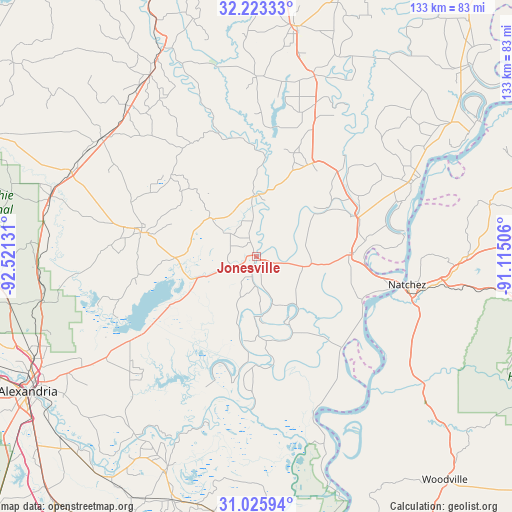
Jonesville GPS coordinates[2]
31° 37' 35.616" North, 91° 49' 5.448" West
| Map corner | latitude | longitude |
|---|---|---|
| Upper-left | 32.22333°, | -92.52131° |
| Center: | 31.62656°, | -91.81818° |
| Lower-right: | 31.02594°, | -91.11506° |
| Map W x H: | 133.1×133.1 km | = 82.7×82.7mi |
| max Lat: | 71.29058° ⇑89.4% North |
| Jonesville: | 31.62656° |
| min Lat: | ⇓10.6% South 19.06759° |
| min Long | Jonesville | max Long |
| -171.73463° | -91.81818° | -66.98998° |
| W 36.3%⇐ | ⇒63.7% E |
Elevation
Elevation of Jonesville is 18 m = 59 ft, and this is 276.8 m = 908 ft below average elevation for this country.
| Max E: |
3189 m = 10463 ft | 89.1% |
| Avg. | 294.8 m = 967 ft | |
| Jonesville | 18 m = 59 ft | |
Min E: |
-60 m = -197 ft | 10.9% |
See also: United States elevation on elevation.city.
Geographical zone
Jonesville is located in North temperate zone (between Tropic of Cancer and the Arctic Circle). Distance of this Northern Tropic circle is 910.6 km =565.8 mi to South.| Distance of | km | miles | from Jonesville |
|---|---|---|---|
| North Pole | 6490.5 | 4033 | to North |
| Arctic Circle | 3884.6 | 2413.8 | to North |
| Tropic Cancer | 910.6 | 565.8 | to South |
| Equator | 3516.5 | 2185.1 | to South |


Nearby cities:
15 places around Jonesville: (largest is in red/bold)
• Clayton
28.1 km =17.5 mi,  67°
67°
• Cloverdale
40.3 km =25 mi,  110°
110°
• Deville
44.5 km =27.7 mi,  227°
227°
• Ferriday
25 km =15.5 mi,  89°
89°
• Harrisonburg
16.2 km =10.1 mi,  358°
358°
• Jena
30.5 km =19 mi,  281°
281°
• Midway
32.5 km =20.2 mi, 282°
• Minorca
32.3 km =20.1 mi,  99°
99°
• Natchez
40 km =24.9 mi, 100°
• Ridgecrest
27.6 km =17.1 mi, 95°
• Sicily Island
28.9 km =18 mi,  32°
32°
• Vidalia
37.8 km =23.5 mi, 100°
• Wallace Ridge
9.3 km =5.8 mi,  354°
354°
• West Ferriday
23.2 km =14.4 mi, 86°
• Wisner
42.3 km =26.3 mi,  21°
21°
Sources, notices
• [Note1] Compared only with cities in United States existing in our database
• [Src1] Map data: © OpenStreetMap contributors (CC-BY-SA)
• [Src2] Other city data from geonames.org with taken over terms of usage.
• [Src3] Geographical zone / Annual Mean Temperature by Robert A. Rohde @ Wikipedia
