Cresaptown geodata
Cresaptown (Maryland) is a populated place; located in United States in America/New_York (GMT-4) time zone. With population of 4,592 people, there are 7552 cities with bigger population in this country. Compared to other cities in United States, 50.1% of cities are located further ↑North; 76.2% of cities are located further ←West and 58.4% of cities have lower elevation than Cresaptown. Note1


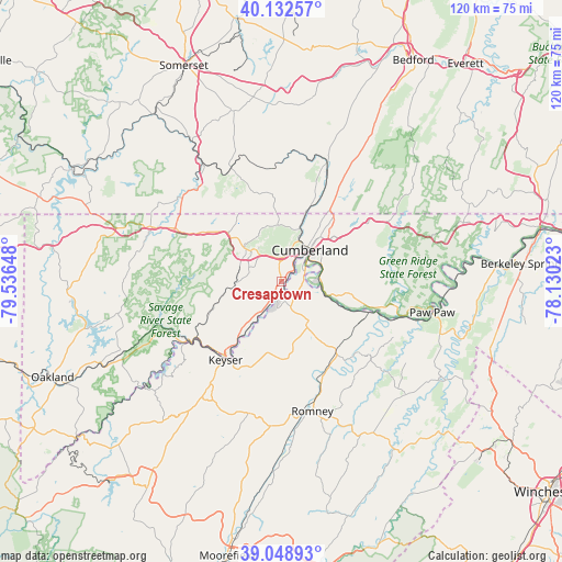
Cresaptown GPS coordinates[2]
39° 35' 34.332" North, 78° 50' 0.06" West
| Map corner | latitude | longitude |
|---|---|---|
| Upper-left | 40.13257°, | -79.53648° |
| Center: | 39.59287°, | -78.83335° |
| Lower-right: | 39.04893°, | -78.13023° |
| Map W x H: | 120.5×120.5 km | = 74.9×74.9mi |
| max Lat: | 71.29058° ⇑50.1% North |
| Cresaptown: | 39.59287° |
| min Lat: | ⇓49.9% South 19.06759° |
| min Long | Cresaptown | max Long |
| -171.73463° | -78.83335° | -66.98998° |
| W 76.2%⇐ | ⇒23.8% E |
Elevation
Elevation of Cresaptown is 232 m = 761 ft, and this is 62.8 m = 206 ft below average elevation for this country.
| Max E: |
3189 m = 10463 ft | 41.6% |
| Avg. | 294.8 m = 967 ft | |
| Cresaptown | 232 m = 761 ft | |
Min E: |
-60 m = -197 ft | 58.4% |
See also: United States elevation on elevation.city.
Geographical zone
Cresaptown is located in North temperate zone (between Tropic of Cancer and the Arctic Circle). Distance of this Northern Tropic circle is 1796.4 km =1116.2 mi to South.| Distance of | km | miles | from Cresaptown |
|---|---|---|---|
| North Pole | 5604.7 | 3482.6 | to North |
| Arctic Circle | 2998.9 | 1863.4 | to North |
| Tropic Cancer | 1796.4 | 1116.2 | to South |
| Equator | 4402.3 | 2735.5 | to South |


Nearby cities:
15 places around Cresaptown: (largest is in red/bold)
• Bel Air
2.6 km =1.6 mi,  212°
212°
• Bowling Green
4.2 km =2.6 mi,  35°
35°
• Carpendale
6.2 km =3.9 mi, 43°
• Cumberland
9 km =5.6 mi, 42°
• Eckhart Mines
8.6 km =5.3 mi,  320°
320°
• Fort Ashby
11.4 km =7.1 mi,  150°
150°
• Frostburg
10.9 km =6.8 mi,  311°
311°
• La Vale
7.2 km =4.5 mi,  15°
15°
• Lonaconing
12.9 km =8 mi,  256°
256°
• Maryland Junction
6.1 km =3.8 mi, 43°
• Mount Savage
12.1 km =7.5 mi,  340°
340°
• Potomac Park
3.2 km =2 mi,  48°
48°
• Rawlings
7.8 km =4.8 mi, 213°
• Ridgeley
7.4 km =4.6 mi, 43°
• Wiley Ford
5.5 km =3.4 mi,  64°
64°
Sources, notices
• [Note1] Compared only with cities in United States existing in our database
• [Src1] Map data: © OpenStreetMap contributors (CC-BY-SA)
• [Src2] Other city data from geonames.org with taken over terms of usage.
• [Src3] Geographical zone / Annual Mean Temperature by Robert A. Rohde @ Wikipedia
