Lonaconing geodata
Lonaconing (Maryland) is a populated place; located in United States in America/New_York (GMT-4) time zone. With population of 1,144 people, there are 15417 cities with bigger population in this country. Compared to other cities in United States, 50.3% of cities are located further ↑North; 75.7% of cities are located further ←West and 86.6% of cities have lower elevation than Lonaconing. Note1


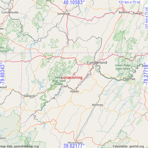
Lonaconing GPS coordinates[2]
39° 33' 57.312" North, 78° 58' 49.08" West
| Map corner | latitude | longitude |
|---|---|---|
| Upper-left | 40.10583°, | -79.68343° |
| Center: | 39.56592°, | -78.9803° |
| Lower-right: | 39.02177°, | -78.27718° |
| Map W x H: | 120.5×120.5 km | = 74.9×74.9mi |
| max Lat: | 71.29058° ⇑50.3% North |
| Lonaconing: | 39.56592° |
| min Lat: | ⇓49.7% South 19.06759° |
| min Long | Lonaconing | max Long |
| -171.73463° | -78.9803° | -66.98998° |
| W 75.7%⇐ | ⇒24.3% E |
Elevation
Elevation of Lonaconing is 457 m = 1499 ft, and this is 162.2 m = 532 ft above average elevation for this country.
| Max E: |
3189 m = 10463 ft | 13.4% |
| Lonaconing | 457 m 1499 ft | |
| Avg. | 294.8 m = 967 ft | |
Min E: |
-60 m = -197 ft | 86.6% |
See also: United States elevation on elevation.city.
Geographical zone
Lonaconing is located in North temperate zone (between Tropic of Cancer and the Arctic Circle). Distance of this Northern Tropic circle is 1793.4 km =1114.4 mi to South.| Distance of | km | miles | from Lonaconing |
|---|---|---|---|
| North Pole | 5607.7 | 3484.5 | to North |
| Arctic Circle | 3001.9 | 1865.3 | to North |
| Tropic Cancer | 1793.4 | 1114.4 | to South |
| Equator | 4399.3 | 2733.6 | to South |


Nearby cities:
15 places around Lonaconing: (largest is in red/bold)
• Bel Air
11.2 km =7 mi,  85°
85°
• Bowling Green
16.4 km =10.2 mi,  66°
66°
• Cresaptown
12.9 km =8 mi,  76°
76°
• Eckhart Mines
12 km =7.5 mi,  36°
36°
• Finzel
16.8 km =10.4 mi,  10°
10°
• Frostburg
11.2 km =7 mi,  23°
23°
• Keyser
13.9 km =8.6 mi,  177°
177°
• La Vale
17.6 km =10.9 mi,  55°
55°
• Maryland Junction
18.3 km =11.4 mi, 66°
• McCoole
13.3 km =8.3 mi, 177°
• Mount Savage
16.8 km =10.4 mi,  30°
30°
• Piedmont
11.1 km =6.9 mi,  211°
211°
• Potomac Park
15.8 km =9.8 mi, 71°
• Rawlings
9 km =5.6 mi,  112°
112°
• Westernport
10.5 km =6.5 mi, 211°
Sources, notices
• [Note1] Compared only with cities in United States existing in our database
• [Src1] Map data: © OpenStreetMap contributors (CC-BY-SA)
• [Src2] Other city data from geonames.org with taken over terms of usage.
• [Src3] Geographical zone / Annual Mean Temperature by Robert A. Rohde @ Wikipedia
