Chillicothe geodata
Chillicothe (Missouri) is a seat of a second-order administrative division; located in United States in America/Chicago (GMT-5) time zone. With population of 9,487 people, there are 4627 cities with bigger population in this country. Compared to other cities in United States, 51.4% of cities are located further ↓South; 67.6% of cities are located further →East and 61% of cities have lower elevation than Chillicothe. Note1
Administrative division(s):
- Level 1: Missouri
- Level 2: Livingston County
- Level 3: Township of Chillicothe


Chillicothe GPS coordinates[2]
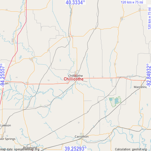
39° 47' 43.044" North, 93° 33' 8.784" West
| Map corner | latitude | longitude |
|---|---|---|
| Upper-left | 40.3334°, | -94.25557° |
| Center: | 39.79529°, | -93.55244° |
| Lower-right: | 39.25293°, | -92.84932° |
| Map W x H: | 120.1×120.1 km | = 74.6×74.6mi |
| max Lat: | 71.29058° ⇑48.6% North |
| Chillicothe: | 39.79529° |
| min Lat: | ⇓51.4% South 19.06759° |
| min Long | Chillicothe | max Long |
| -171.73463° | -93.55244° | -66.98998° |
| W 32.4%⇐ | ⇒67.6% E |
Elevation
Elevation of Chillicothe is 244 m = 801 ft, and this is 50.8 m = 167 ft below average elevation for this country.
| Max E: |
3189 m = 10463 ft | 39% |
| Avg. | 294.8 m = 967 ft | |
| Chillicothe | 244 m = 801 ft | |
Min E: |
-60 m = -197 ft | 61% |
See also: United States elevation on elevation.city.
Geographical zone
Chillicothe is located in North temperate zone (between Tropic of Cancer and the Arctic Circle). Distance of this Northern Tropic circle is 1818.9 km =1130.2 mi to South.| Distance of | km | miles | from Chillicothe |
|---|---|---|---|
| North Pole | 5582.2 | 3468.6 | to North |
| Arctic Circle | 2976.4 | 1849.4 | to North |
| Tropic Cancer | 1818.9 | 1130.2 | to South |
| Equator | 4424.8 | 2749.4 | to South |


Nearby cities:
15 places around Chillicothe: (largest is in red/bold)
• Braymer
31.2 km =19.4 mi,  221°
221°
• Brookfield
40.9 km =25.4 mi,  91°
91°
• Brunswick
54.9 km =34.1 mi,  138°
138°
• Cameron
59.2 km =36.8 mi,  264°
264°
• Carrollton
48.8 km =30.3 mi,  174°
174°
• Gallatin
37.4 km =23.2 mi,  290°
290°
• Hamilton
38.5 km =23.9 mi, 261°
• Jamesport
29.1 km =18.1 mi,  313°
313°
• Kingston
44.8 km =27.8 mi,  247°
247°
• Linneus
32.4 km =20.1 mi,  73°
73°
• Marceline
52.5 km =32.6 mi,  100°
100°
• Milan
58.1 km =36.1 mi,  38°
38°
• Norborne
55.8 km =34.7 mi,  191°
191°
• Polo
49.8 km =30.9 mi,  237°
237°
• Trenton
32 km =19.9 mi,  350°
350°
Sources, notices
• [Note1] Compared only with cities in United States existing in our database
• [Src1] Map data: © OpenStreetMap contributors (CC-BY-SA)
• [Src2] Other city data from geonames.org with taken over terms of usage.
• [Src3] Geographical zone / Annual Mean Temperature by Robert A. Rohde @ Wikipedia
