Anguilla geodata
Anguilla (Mississippi) is a populated place; located in United States in America/Chicago (GMT-5) time zone. With population of 666 people, there are 19012 cities with bigger population in this country. Compared to other cities in United States, 85.2% of cities are located further ↑North; 61.7% of cities are located further →East and 83.6% of cities have higher elevation than Anguilla. Note1


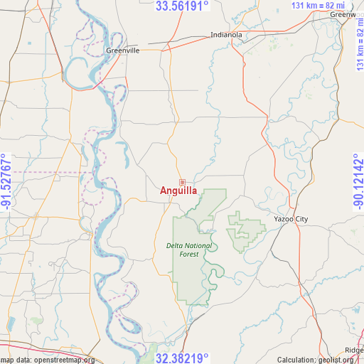
Anguilla GPS coordinates[2]
32° 58' 26.472" North, 90° 49' 28.344" West
| Map corner | latitude | longitude |
|---|---|---|
| Upper-left | 33.56191°, | -91.52767° |
| Center: | 32.97402°, | -90.82454° |
| Lower-right: | 32.38219°, | -90.12142° |
| Map W x H: | 131.2×131.2 km | = 81.5×81.5mi |
| max Lat: | 71.29058° ⇑85.2% North |
| Anguilla: | 32.97402° |
| min Lat: | ⇓14.8% South 19.06759° |
| min Long | Anguilla | max Long |
| -171.73463° | -90.82454° | -66.98998° |
| W 38.3%⇐ | ⇒61.7% E |
Elevation
Elevation of Anguilla is 33 m = 108 ft, and this is 261.8 m = 859 ft below average elevation for this country.
| Max E: |
3189 m = 10463 ft | 83.6% |
| Avg. | 294.8 m = 967 ft | |
| Anguilla | 33 m = 108 ft | |
Min E: |
-60 m = -197 ft | 16.4% |
See also: United States elevation on elevation.city.
Geographical zone
Anguilla is located in North temperate zone (between Tropic of Cancer and the Arctic Circle). Distance of this Northern Tropic circle is 1060.4 km =658.9 mi to South.| Distance of | km | miles | from Anguilla |
|---|---|---|---|
| North Pole | 6340.7 | 3939.9 | to North |
| Arctic Circle | 3734.8 | 2320.7 | to North |
| Tropic Cancer | 1060.4 | 658.9 | to South |
| Equator | 3666.4 | 2278.2 | to South |


Nearby cities:
15 places around Anguilla: (largest is in red/bold)
• Belzoni
39 km =24.2 mi,  53°
53°
• Eudora
43.5 km =27 mi,  290°
290°
• Greenville
53.1 km =33 mi,  335°
335°
• Hollandale
21.9 km =13.6 mi,  352°
352°
• Indianola
55.3 km =34.4 mi,  16°
16°
• Inverness
47.4 km =29.5 mi,  27°
27°
• Isola
38.6 km =24 mi, 34°
• Lake Providence
37.4 km =23.2 mi,  239°
239°
• Lake Village
58 km =36 mi,  312°
312°
• Leland
48.4 km =30.1 mi, 351°
• Mayersville
22.6 km =14 mi,  249°
249°
• Metcalfe
56 km =34.8 mi, 342°
• Oak Grove
54.1 km =33.6 mi,  256°
256°
• Rolling Fork
9 km =5.6 mi,  213°
213°
• Yazoo City
41.3 km =25.7 mi,  108°
108°
Sources, notices
• [Note1] Compared only with cities in United States existing in our database
• [Src1] Map data: © OpenStreetMap contributors (CC-BY-SA)
• [Src2] Other city data from geonames.org with taken over terms of usage.
• [Src3] Geographical zone / Annual Mean Temperature by Robert A. Rohde @ Wikipedia
