Boone geodata
Boone (North Carolina) is a seat of a second-order administrative division; located in United States in America/New_York (GMT-4) time zone. With population of 18,156 people, there are 2764 cities with bigger population in this country. Compared to other cities in United States, 69.3% of cities are located further ↑North; 66.8% of cities are located further ←West and 93.3% of cities have lower elevation than Boone. Note1
Administrative division(s):
- Level 1: North Carolina
- Level 2: Watauga County
- Level 3: Township of Boone


Boone GPS coordinates[2]
36° 13' 0.444" North, 81° 40' 28.38" West
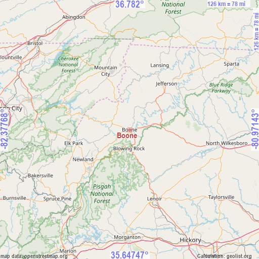
| Map corner | latitude | longitude |
|---|---|---|
| Upper-left | 36.782°, | -82.37768° |
| Center: | 36.21679°, | -81.67455° |
| Lower-right: | 35.64747°, | -80.97143° |
| Map W x H: | 126.1×126.1 km | = 78.4×78.4mi |
| max Lat: | 71.29058° ⇑69.3% North |
| Boone: | 36.21679° |
| min Lat: | ⇓30.7% South 19.06759° |
| min Long | Boone | max Long |
| -171.73463° | -81.67455° | -66.98998° |
| W 66.8%⇐ | ⇒33.2% E |
Elevation
Elevation of Boone is 984 m = 3228 ft, and this is 689.2 m = 2261 ft above average elevation for this country.
| Max E: |
3189 m = 10463 ft | 6.7% |
| Boone | 984 m 3228 ft | |
| Avg. | 294.8 m = 967 ft | |
Min E: |
-60 m = -197 ft | 93.3% |
See also: United States elevation on elevation.city.
Geographical zone
Boone is located in North temperate zone (between Tropic of Cancer and the Arctic Circle). Distance of this Northern Tropic circle is 1421 km =883 mi to South.| Distance of | km | miles | from Boone |
|---|---|---|---|
| North Pole | 5980.1 | 3715.9 | to North |
| Arctic Circle | 3374.2 | 2096.6 | to North |
| Tropic Cancer | 1421 | 883 | to South |
| Equator | 4026.9 | 2502.2 | to South |


Nearby cities:
15 places around Boone: (largest is in red/bold)
• Banner Elk
18.7 km =11.6 mi,  251°
251°
• Blowing Rock
9.1 km =5.7 mi,  181°
181°
• Cajahs Mountain
44.1 km =27.4 mi,  164°
164°
• Cricket
43.4 km =27 mi,  96°
96°
• Foscoe
10.2 km =6.3 mi,  233°
233°
• Gamewell
39.3 km =24.4 mi,  169°
169°
• Hudson
44 km =27.3 mi, 158°
• Jefferson
28.9 km =18 mi,  38°
38°
• Lenoir
35.8 km =22.2 mi, 160°
• Millers Creek
39.3 km =24.4 mi,  94°
94°
• Mountain City
30.9 km =19.2 mi,  337°
337°
• Mulberry
44.4 km =27.6 mi, 86°
• Newland
26.9 km =16.7 mi,  237°
237°
• Roan Mountain
35.6 km =22.1 mi,  266°
266°
• West Jefferson
26.4 km =16.4 mi, 38°
Sources, notices
• [Note1] Compared only with cities in United States existing in our database
• [Src1] Map data: © OpenStreetMap contributors (CC-BY-SA)
• [Src2] Other city data from geonames.org with taken over terms of usage.
• [Src3] Geographical zone / Annual Mean Temperature by Robert A. Rohde @ Wikipedia
