Granite Falls geodata
Granite Falls (North Carolina) is a populated place; located in United States in America/New_York (GMT-4) time zone. With population of 4,662 people, there are 7473 cities with bigger population in this country. Compared to other cities in United States, 71.4% of cities are located further ↑North; 68% of cities are located further ←West and 81% of cities have lower elevation than Granite Falls. Note1
Administrative division(s):
- Level 1: North Carolina
- Level 2: Caldwell County
- Level 3: Township of Lovelady


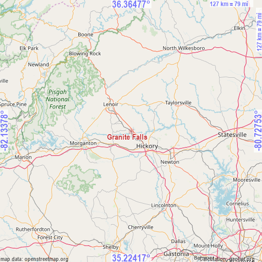
Granite Falls GPS coordinates[2]
35° 47' 47.472" North, 81° 25' 50.34" West
| Map corner | latitude | longitude |
|---|---|---|
| Upper-left | 36.36477°, | -82.13378° |
| Center: | 35.79652°, | -81.43065° |
| Lower-right: | 35.22417°, | -80.72753° |
| Map W x H: | 126.8×126.8 km | = 78.8×78.8mi |
| max Lat: | 71.29058° ⇑71.4% North |
| Granite Falls: | 35.79652° |
| min Lat: | ⇓28.6% South 19.06759° |
| min Long | Granite Falls | max Long |
| -171.73463° | -81.43065° | -66.98998° |
| W 68%⇐ | ⇒32% E |
Elevation
Elevation of Granite Falls is 365 m = 1198 ft, and this is 70.2 m = 230 ft above average elevation for this country.
| Max E: |
3189 m = 10463 ft | 19% |
| Granite Falls | 365 m 1198 ft | |
| Avg. | 294.8 m = 967 ft | |
Min E: |
-60 m = -197 ft | 81% |
See also: United States elevation on elevation.city.
Geographical zone
Granite Falls is located in North temperate zone (between Tropic of Cancer and the Arctic Circle). Distance of this Northern Tropic circle is 1374.3 km =854 mi to South.| Distance of | km | miles | from Granite Falls |
|---|---|---|---|
| North Pole | 6026.9 | 3744.9 | to North |
| Arctic Circle | 3421 | 2125.7 | to North |
| Tropic Cancer | 1374.3 | 854 | to South |
| Equator | 3980.2 | 2473.2 | to South |


Nearby cities:
15 places around Granite Falls: (largest is in red/bold)
• Bethlehem
11.6 km =7.2 mi,  73°
73°
• Cajahs Mountain
10.9 km =6.8 mi,  293°
293°
• Connelly Springs
9.6 km =6 mi,  231°
231°
• Hickory
10.7 km =6.6 mi,  131°
131°
• Hildebran
9.2 km =5.7 mi,  175°
175°
• Hudson
8.2 km =5.1 mi,  314°
314°
• Icard
8.5 km =5.3 mi,  205°
205°
• Longview
8.6 km =5.3 mi,  150°
150°
• Mountain View
13.8 km =8.6 mi,  156°
156°
• Northlakes
5.3 km =3.3 mi,  108°
108°
• Rhodhiss
2.5 km =1.6 mi, 181°
• Rutherford College
9.9 km =6.2 mi,  237°
237°
• Saint Stephens
14.6 km =9.1 mi,  104°
104°
• Sawmills
5.1 km =3.2 mi, 308°
• Valdese
13.5 km =8.4 mi, 242°
Sources, notices
• [Note1] Compared only with cities in United States existing in our database
• [Src1] Map data: © OpenStreetMap contributors (CC-BY-SA)
• [Src2] Other city data from geonames.org with taken over terms of usage.
• [Src3] Geographical zone / Annual Mean Temperature by Robert A. Rohde @ Wikipedia
