Greenevers geodata
Greenevers (North Carolina) is a populated place; located in United States in America/New_York (GMT-4) time zone. With population of 651 people, there are 19169 cities with bigger population in this country. Compared to other cities in United States, 76.3% of cities are located further ↑North; 77.9% of cities are located further ←West and 89.1% of cities have higher elevation than Greenevers. Note1
Administrative division(s):
- Level 1: North Carolina
- Level 2: Duplin County
- Level 3: Township of Island Creek


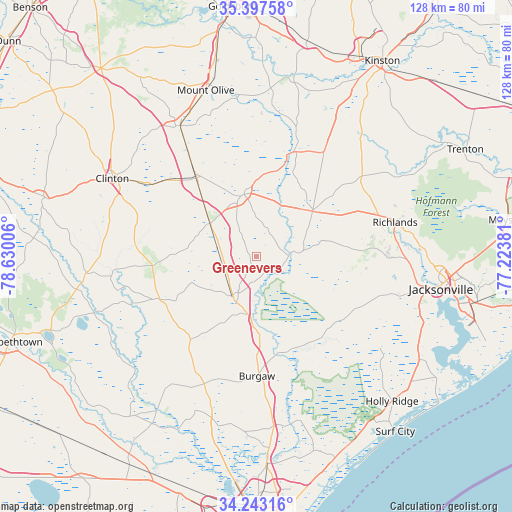
Greenevers GPS coordinates[2]
34° 49' 20.604" North, 77° 55' 36.948" West
| Map corner | latitude | longitude |
|---|---|---|
| Upper-left | 35.39758°, | -78.63006° |
| Center: | 34.82239°, | -77.92693° |
| Lower-right: | 34.24316°, | -77.22381° |
| Map W x H: | 128.4×128.4 km | = 79.8×79.8mi |
| max Lat: | 71.29058° ⇑76.3% North |
| Greenevers: | 34.82239° |
| min Lat: | ⇓23.7% South 19.06759° |
| min Long | Greenevers | max Long |
| -171.73463° | -77.92693° | -66.98998° |
| W 77.9%⇐ | ⇒22.1% E |
Elevation
Elevation of Greenevers is 18 m = 59 ft, and this is 276.8 m = 908 ft below average elevation for this country.
| Max E: |
3189 m = 10463 ft | 89.1% |
| Avg. | 294.8 m = 967 ft | |
| Greenevers | 18 m = 59 ft | |
Min E: |
-60 m = -197 ft | 10.9% |
See also: United States elevation on elevation.city.
Geographical zone
Greenevers is located in North temperate zone (between Tropic of Cancer and the Arctic Circle). Distance of this Northern Tropic circle is 1266 km =786.7 mi to South.| Distance of | km | miles | from Greenevers |
|---|---|---|---|
| North Pole | 6135.2 | 3812.2 | to North |
| Arctic Circle | 3529.3 | 2193 | to North |
| Tropic Cancer | 1266 | 786.7 | to South |
| Equator | 3871.9 | 2405.9 | to South |


Nearby cities:
15 places around Greenevers: (largest is in red/bold)
• Beulaville
17.9 km =11.1 mi,  51°
51°
• Burgaw
30.1 km =18.7 mi,  179°
179°
• Calypso
40.3 km =25 mi,  336°
336°
• Clinton
41.1 km =25.5 mi,  298°
298°
• Faison
37.8 km =23.5 mi,  329°
329°
• Garland
42.8 km =26.6 mi,  264°
264°
• Half Moon
42.7 km =26.5 mi,  89°
89°
• Kenansville
15.9 km =9.9 mi,  348°
348°
• Magnolia
14.2 km =8.8 mi,  305°
305°
• Pink Hill
30.7 km =19.1 mi,  32°
32°
• Richlands
35.7 km =22.2 mi,  76°
76°
• Rocky Point
43.2 km =26.8 mi, 175°
• Rose Hill
8.8 km =5.5 mi,  274°
274°
• Wallace
11.5 km =7.1 mi,  212°
212°
• Warsaw
24.7 km =15.3 mi,  322°
322°
Sources, notices
• [Note1] Compared only with cities in United States existing in our database
• [Src1] Map data: © OpenStreetMap contributors (CC-BY-SA)
• [Src2] Other city data from geonames.org with taken over terms of usage.
• [Src3] Geographical zone / Annual Mean Temperature by Robert A. Rohde @ Wikipedia
