Walkertown geodata
Walkertown (North Carolina) is a populated place; located in United States in America/New_York (GMT-4) time zone. With population of 4,969 people, there are 7209 cities with bigger population in this country. Compared to other cities in United States, 69.5% of cities are located further ↑North; 72.5% of cities are located further ←West and 73.1% of cities have lower elevation than Walkertown. Note1
Administrative division(s):
- Level 1: North Carolina
- Level 2: Forsyth County
- Level 3: Township of Salem Chapel


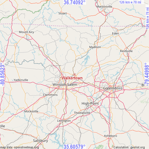
Walkertown GPS coordinates[2]
36° 10' 31.476" North, 80° 9' 11.16" West
| Map corner | latitude | longitude |
|---|---|---|
| Upper-left | 36.74092°, | -80.85623° |
| Center: | 36.17541°, | -80.1531° |
| Lower-right: | 35.60579°, | -79.44998° |
| Map W x H: | 126.2×126.2 km | = 78.4×78.4mi |
| max Lat: | 71.29058° ⇑69.5% North |
| Walkertown: | 36.17541° |
| min Lat: | ⇓30.5% South 19.06759° |
| min Long | Walkertown | max Long |
| -171.73463° | -80.1531° | -66.98998° |
| W 72.5%⇐ | ⇒27.5% E |
Elevation
Elevation of Walkertown is 302 m = 991 ft, and this is 7.2 m = 24 ft above average elevation for this country.
| Max E: |
3189 m = 10463 ft | 26.9% |
| Walkertown | 302 m 991 ft | |
| Avg. | 294.8 m = 967 ft | |
Min E: |
-60 m = -197 ft | 73.1% |
See also: United States elevation on elevation.city.
Geographical zone
Walkertown is located in North temperate zone (between Tropic of Cancer and the Arctic Circle). Distance of this Northern Tropic circle is 1416.4 km =880.1 mi to South.| Distance of | km | miles | from Walkertown |
|---|---|---|---|
| North Pole | 5984.7 | 3718.7 | to North |
| Arctic Circle | 3378.8 | 2099.5 | to North |
| Tropic Cancer | 1416.4 | 880.1 | to South |
| Equator | 4022.3 | 2499.3 | to South |


Nearby cities:
15 places around Walkertown: (largest is in red/bold)
• Clemmons
26.8 km =16.7 mi,  230°
230°
• Danbury
26.4 km =16.4 mi,  349°
349°
• Germanton
12 km =7.5 mi,  324°
324°
• Kernersville
9.4 km =5.8 mi,  130°
130°
• King
21.9 km =13.6 mi,  302°
302°
• Lewisville
25.4 km =15.8 mi,  249°
249°
• Midway
25.4 km =15.8 mi,  193°
193°
• Oak Ridge
14.7 km =9.1 mi,  90°
90°
• Rural Hall
14.5 km =9 mi, 299°
• Stokesdale
17 km =10.6 mi,  66°
66°
• Summerfield
22.6 km =14 mi,  80°
80°
• Tobaccoville
20.8 km =12.9 mi,  289°
289°
• Wallburg
18.4 km =11.4 mi,  176°
176°
• Walnut Cove
13.4 km =8.3 mi,  4°
4°
• Winston-Salem
11.7 km =7.3 mi,  224°
224°
Sources, notices
• [Note1] Compared only with cities in United States existing in our database
• [Src1] Map data: © OpenStreetMap contributors (CC-BY-SA)
• [Src2] Other city data from geonames.org with taken over terms of usage.
• [Src3] Geographical zone / Annual Mean Temperature by Robert A. Rohde @ Wikipedia
