Beach Haven West geodata
Beach Haven West (New Jersey) is a populated place; located in United States in America/New_York (GMT-4) time zone. With population of 3,896 people, there are 8330 cities with bigger population in this country. Compared to other cities in United States, 50.5% of cities are located further ↓South; 89.3% of cities are located further ←West and 99.1% of cities have higher elevation than Beach Haven West. Note1


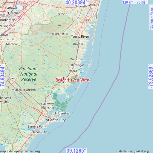
Beach Haven West GPS coordinates[2]
39° 40' 11.424" North, 74° 13' 54.516" West
| Map corner | latitude | longitude |
|---|---|---|
| Upper-left | 40.20894°, | -74.93494° |
| Center: | 39.66984°, | -74.23181° |
| Lower-right: | 39.1265°, | -73.52869° |
| Map W x H: | 120.4×120.4 km | = 74.8×74.8mi |
| max Lat: | 71.29058° ⇑49.5% North |
| Beach Haven West: | 39.66984° |
| min Lat: | ⇓50.5% South 19.06759° |
| min Long | Beach Haven Wes | max Long |
| -171.73463° | -74.23181° | -66.98998° |
| W 89.3%⇐ | ⇒10.7% E |
Elevation
Elevation of Beach Haven West is 3 m = 10 ft, and this is 291.8 m = 957 ft below average elevation for this country.
| Max E: |
3189 m = 10463 ft | 99.1% |
| Avg. | 294.8 m = 967 ft | |
| Beach Haven West | 3 m = 10 ft | |
Min E: |
-60 m = -197 ft | 0.9% |
See also: United States elevation on elevation.city.
Geographical zone
Beach Haven West is located in North temperate zone (between Tropic of Cancer and the Arctic Circle). Distance of this Northern Tropic circle is 1805 km =1121.6 mi to South.| Distance of | km | miles | from Beach Haven West |
|---|---|---|---|
| North Pole | 5596.2 | 3477.3 | to North |
| Arctic Circle | 2990.3 | 1858.1 | to North |
| Tropic Cancer | 1805 | 1121.6 | to South |
| Equator | 4410.9 | 2740.8 | to South |


Nearby cities:
15 places around Beach Haven West: (largest is in red/bold)
• Barnegat
9.3 km =5.8 mi,  4°
4°
• Barnegat Light
14.5 km =9 mi,  47°
47°
• Bayville
27.4 km =17 mi,  13°
13°
• Beach Haven
12.3 km =7.6 mi,  184°
184°
• Forked River
19.2 km =11.9 mi, 10°
• Manahawkin
3.7 km =2.3 mi,  320°
320°
• Mystic Island
19 km =11.8 mi,  222°
222°
• North Beach Haven
10.7 km =6.6 mi, 179°
• Ocean Acres
9.2 km =5.7 mi,  332°
332°
• Port Republic
27.4 km =17 mi,  232°
232°
• Ship Bottom
5.3 km =3.3 mi,  124°
124°
• Smithville
27.5 km =17.1 mi, 224°
• Surf City
5.8 km =3.6 mi,  98°
98°
• Tuckerton
11.9 km =7.4 mi, 231°
• Waretown
13.9 km =8.6 mi, 13°
Sources, notices
• [Note1] Compared only with cities in United States existing in our database
• [Src1] Map data: © OpenStreetMap contributors (CC-BY-SA)
• [Src2] Other city data from geonames.org with taken over terms of usage.
• [Src3] Geographical zone / Annual Mean Temperature by Robert A. Rohde @ Wikipedia
