Amelia geodata
Amelia (Ohio) is a populated place; located in United States in America/New_York (GMT-4) time zone. With population of 4,932 people, there are 7252 cities with bigger population in this country. Compared to other cities in United States, 54.5% of cities are located further ↑North; 58.6% of cities are located further ←West and 66.6% of cities have lower elevation than Amelia. Note1


Amelia GPS coordinates[2]
39° 1' 42.24" North, 84° 13' 3.756" West
| Map corner | latitude | longitude |
|---|---|---|
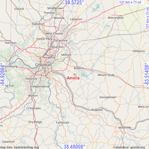
| Upper-left | 39.5725°, | -84.92084° |
| Center: | 39.0284°, | -84.21771° |
| Lower-right: | 38.48008°, | -83.51459° |
| Map W x H: | 121.5×121.5 km | = 75.5×75.5mi |
| max Lat: | 71.29058° ⇑54.5% North |
| Amelia: | 39.0284° |
| min Lat: | ⇓45.5% South 19.06759° |
| min Long | Amelia | max Long |
| -171.73463° | -84.21771° | -66.98998° |
| W 58.6%⇐ | ⇒41.4% E |
Elevation
Elevation of Amelia is 269 m = 883 ft, and this is 25.8 m = 85 ft below average elevation for this country.
| Max E: |
3189 m = 10463 ft | 33.4% |
| Avg. | 294.8 m = 967 ft | |
| Amelia | 269 m = 883 ft | |
Min E: |
-60 m = -197 ft | 66.6% |
See also: United States elevation on elevation.city.
Geographical zone
Amelia is located in North temperate zone (between Tropic of Cancer and the Arctic Circle). Distance of this Northern Tropic circle is 1733.6 km =1077.2 mi to South.| Distance of | km | miles | from Amelia |
|---|---|---|---|
| North Pole | 5667.5 | 3521.6 | to North |
| Arctic Circle | 3061.6 | 1902.4 | to North |
| Tropic Cancer | 1733.6 | 1077.2 | to South |
| Equator | 4339.6 | 2696.5 | to South |


Nearby cities:
15 places around Amelia: (largest is in red/bold)
• Batavia
6.5 km =4 mi,  33°
33°
• Bethel
13.8 km =8.6 mi,  121°
121°
• Cherry Grove
10.2 km =6.3 mi,  298°
298°
• Dry Run
12.9 km =8 mi,  310°
310°
• Forestville
12.1 km =7.5 mi, 295°
• Fruit Hill
13.7 km =8.5 mi,  292°
292°
• Mount Carmel
11.4 km =7.1 mi,  319°
319°
• New Richmond
10.4 km =6.5 mi,  211°
211°
• Owensville
12.6 km =7.8 mi, 34°
• Salem Heights
14.7 km =9.1 mi, 289°
• Sherwood
13.9 km =8.6 mi, 296°
• Silver Grove
14.9 km =9.3 mi,  272°
272°
• Summerside
10.5 km =6.5 mi, 324°
• Williamsburg
14.5 km =9 mi,  78°
78°
• Withamsville
7.2 km =4.5 mi, 301°
Sources, notices
• [Note1] Compared only with cities in United States existing in our database
• [Src1] Map data: © OpenStreetMap contributors (CC-BY-SA)
• [Src2] Other city data from geonames.org with taken over terms of usage.
• [Src3] Geographical zone / Annual Mean Temperature by Robert A. Rohde @ Wikipedia
