Jay geodata
Jay (Oklahoma) is a seat of a second-order administrative division; located in United States in America/Chicago (GMT-5) time zone. With population of 2,483 people, there are 10663 cities with bigger population in this country. Compared to other cities in United States, 68.4% of cities are located further ↑North; 70.6% of cities are located further →East and 75.7% of cities have lower elevation than Jay. Note1


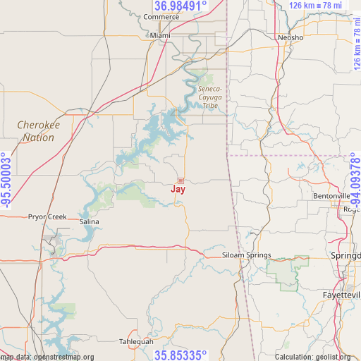
Jay GPS coordinates[2]
36° 25' 16.284" North, 94° 47' 48.84" West
| Map corner | latitude | longitude |
|---|---|---|
| Upper-left | 36.98491°, | -95.50003° |
| Center: | 36.42119°, | -94.7969° |
| Lower-right: | 35.85335°, | -94.09378° |
| Map W x H: | 125.8×125.8 km | = 78.2×78.2mi |
| max Lat: | 71.29058° ⇑68.4% North |
| Jay: | 36.42119° |
| min Lat: | ⇓31.6% South 19.06759° |
| min Long | Jay | max Long |
| -171.73463° | -94.7969° | -66.98998° |
| W 29.4%⇐ | ⇒70.6% E |
Elevation
Elevation of Jay is 318 m = 1043 ft, and this is 23.2 m = 76 ft above average elevation for this country.
| Max E: |
3189 m = 10463 ft | 24.3% |
| Jay | 318 m 1043 ft | |
| Avg. | 294.8 m = 967 ft | |
Min E: |
-60 m = -197 ft | 75.7% |
See also: United States elevation on elevation.city.
Geographical zone
Jay is located in North temperate zone (between Tropic of Cancer and the Arctic Circle). Distance of this Northern Tropic circle is 1443.7 km =897.1 mi to South.| Distance of | km | miles | from Jay |
|---|---|---|---|
| North Pole | 5957.4 | 3701.8 | to North |
| Arctic Circle | 3351.5 | 2082.5 | to North |
| Tropic Cancer | 1443.7 | 897.1 | to South |
| Equator | 4049.7 | 2516.4 | to South |


Nearby cities:
15 places around Jay: (largest is in red/bold)
• Bernice
24.2 km =15 mi,  333°
333°
• Cleora
23.5 km =14.6 mi,  318°
318°
• Colcord
19.8 km =12.3 mi,  151°
151°
• Copeland
26.2 km =16.3 mi,  353°
353°
• Decatur
31.5 km =19.6 mi,  107°
107°
• Flint Creek
27.6 km =17.1 mi,  169°
169°
• Gentry
32.8 km =20.4 mi,  121°
121°
• Gravette
30.7 km =19.1 mi,  89°
89°
• Grove
19.3 km =12 mi,  7°
7°
• Kansas
24 km =14.9 mi,  180°
180°
• Kenwood
20.7 km =12.9 mi,  234°
234°
• Langley
22.9 km =14.2 mi,  281°
281°
• Noel
31.1 km =19.3 mi,  63°
63°
• South West City
19.5 km =12.1 mi, 58°
• Sulphur Springs
31 km =19.3 mi,  77°
77°
Sources, notices
• [Note1] Compared only with cities in United States existing in our database
• [Src1] Map data: © OpenStreetMap contributors (CC-BY-SA)
• [Src2] Other city data from geonames.org with taken over terms of usage.
• [Src3] Geographical zone / Annual Mean Temperature by Robert A. Rohde @ Wikipedia
