Chester Heights geodata
Chester Heights (Pennsylvania) is a populated place; located in United States in America/New_York (GMT-4) time zone. With population of 2,626 people, there are 10338 cities with bigger population in this country. Compared to other cities in United States, 52.3% of cities are located further ↓South; 85.8% of cities are located further ←West and 69.2% of cities have higher elevation than Chester Heights. Note1
Administrative division(s):
- Level 1: Pennsylvania
- Level 2: Delaware County
- Level 3: Borough of Chester Heights


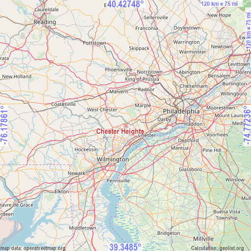
Chester Heights GPS coordinates[2]
39° 53' 24.396" North, 75° 28' 31.728" West
| Map corner | latitude | longitude |
|---|---|---|
| Upper-left | 40.42748°, | -76.17861° |
| Center: | 39.89011°, | -75.47548° |
| Lower-right: | 39.3485°, | -74.77236° |
| Map W x H: | 120×120 km | = 74.6×74.6mi |
| max Lat: | 71.29058° ⇑47.7% North |
| Chester Heights: | 39.89011° |
| min Lat: | ⇓52.3% South 19.06759° |
| min Long | Chester Heights | max Long |
| -171.73463° | -75.47548° | -66.98998° |
| W 85.8%⇐ | ⇒14.2% E |
Elevation
Elevation of Chester Heights is 105 m = 344 ft, and this is 189.8 m = 623 ft below average elevation for this country.
| Max E: |
3189 m = 10463 ft | 69.2% |
| Avg. | 294.8 m = 967 ft | |
| Chester Heights | 105 m = 344 ft | |
Min E: |
-60 m = -197 ft | 30.8% |
See also: United States elevation on elevation.city.
Geographical zone
Chester Heights is located in North temperate zone (between Tropic of Cancer and the Arctic Circle). Distance of this Northern Tropic circle is 1829.4 km =1136.7 mi to South.| Distance of | km | miles | from Chester Heights |
|---|---|---|---|
| North Pole | 5571.7 | 3462.1 | to North |
| Arctic Circle | 2965.8 | 1842.9 | to North |
| Tropic Cancer | 1829.4 | 1136.7 | to South |
| Equator | 4435.4 | 2756 | to South |


Nearby cities:
15 places around Chester Heights: (largest is in red/bold)
• Boothwyn
7.3 km =4.5 mi,  156°
156°
• Brookhaven
8.3 km =5.2 mi,  106°
106°
• Chester
11.1 km =6.9 mi, 113°
• Claymont
10 km =6.2 mi,  172°
172°
• Eddystone
11.7 km =7.3 mi, 106°
• Lima
4.3 km =2.7 mi,  44°
44°
• Linwood
8.3 km =5.2 mi,  148°
148°
• Marcus Hook
9.3 km =5.8 mi, 148°
• Media
8.1 km =5 mi,  68°
68°
• Parkside
8.8 km =5.5 mi, 109°
• Rose Valley
7.8 km =4.8 mi,  84°
84°
• Swarthmore
10.8 km =6.7 mi, 82°
• Trainer
8.7 km =5.4 mi,  143°
143°
• Upland
8.9 km =5.5 mi,  117°
117°
• Village Green-Green Ridge
5.2 km =3.2 mi, 124°
Sources, notices
• [Note1] Compared only with cities in United States existing in our database
• [Src1] Map data: © OpenStreetMap contributors (CC-BY-SA)
• [Src2] Other city data from geonames.org with taken over terms of usage.
• [Src3] Geographical zone / Annual Mean Temperature by Robert A. Rohde @ Wikipedia
