Spring Grove geodata
Spring Grove (Pennsylvania) is a populated place; located in United States in America/New_York (GMT-4) time zone. With population of 2,168 people, there are 11422 cities with bigger population in this country. Compared to other cities in United States, 52.2% of cities are located further ↓South; 81.1% of cities are located further ←West and 62.1% of cities have higher elevation than Spring Grove. Note1
Administrative division(s):
- Level 1: Pennsylvania
- Level 2: York County
- Level 3: Borough of Spring Grove


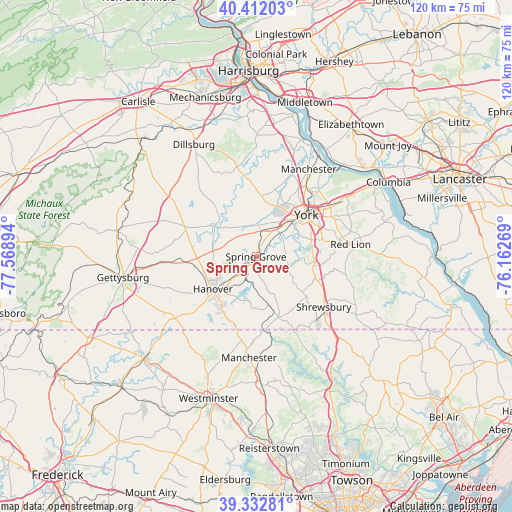
Spring Grove GPS coordinates[2]
39° 52' 28.344" North, 76° 51' 56.916" West
| Map corner | latitude | longitude |
|---|---|---|
| Upper-left | 40.41203°, | -77.56894° |
| Center: | 39.87454°, | -76.86581° |
| Lower-right: | 39.33281°, | -76.16269° |
| Map W x H: | 120×120 km | = 74.6×74.6mi |
| max Lat: | 71.29058° ⇑47.8% North |
| Spring Grove: | 39.87454° |
| min Lat: | ⇓52.2% South 19.06759° |
| min Long | Spring Grove | max Long |
| -171.73463° | -76.86581° | -66.98998° |
| W 81.1%⇐ | ⇒18.9% E |
Elevation
Elevation of Spring Grove is 144 m = 472 ft, and this is 150.8 m = 495 ft below average elevation for this country.
| Max E: |
3189 m = 10463 ft | 62.1% |
| Avg. | 294.8 m = 967 ft | |
| Spring Grove | 144 m = 472 ft | |
Min E: |
-60 m = -197 ft | 37.9% |
See also: United States elevation on elevation.city.
Geographical zone
Spring Grove is located in North temperate zone (between Tropic of Cancer and the Arctic Circle). Distance of this Northern Tropic circle is 1827.7 km =1135.7 mi to South.| Distance of | km | miles | from Spring Grove |
|---|---|---|---|
| North Pole | 5573.4 | 3463.1 | to North |
| Arctic Circle | 2967.5 | 1843.9 | to North |
| Tropic Cancer | 1827.7 | 1135.7 | to South |
| Equator | 4433.6 | 2754.9 | to South |


Nearby cities:
15 places around Spring Grove: (largest is in red/bold)
• Abbottstown
10.2 km =6.3 mi,  277°
277°
• Dover
14.2 km =8.8 mi,  5°
5°
• East Berlin
11.9 km =7.4 mi,  306°
306°
• Grantley
13.8 km =8.6 mi,  57°
57°
• Hanover
12.9 km =8 mi,  230°
230°
• Jacobus
13.3 km =8.3 mi,  85°
85°
• Jefferson
6.7 km =4.2 mi,  162°
162°
• Loganville
13.7 km =8.5 mi,  98°
98°
• Midway
13.8 km =8.6 mi,  237°
237°
• New Salem
7.2 km =4.5 mi,  65°
65°
• Parkville
13.3 km =8.3 mi,  218°
218°
• Seven Valleys
8.6 km =5.3 mi, 104°
• Shiloh
12.9 km =8 mi,  26°
26°
• Weigelstown
12.7 km =7.9 mi,  16°
16°
• West York
13.1 km =8.1 mi,  48°
48°
Sources, notices
• [Note1] Compared only with cities in United States existing in our database
• [Src1] Map data: © OpenStreetMap contributors (CC-BY-SA)
• [Src2] Other city data from geonames.org with taken over terms of usage.
• [Src3] Geographical zone / Annual Mean Temperature by Robert A. Rohde @ Wikipedia
