Rockwood geodata
Rockwood (Tennessee) is a populated place; located in United States in America/New_York (GMT-4) time zone. With population of 5,425 people, there are 6819 cities with bigger population in this country. Compared to other cities in United States, 71.1% of cities are located further ↑North; 56.7% of cities are located further ←West and 67.2% of cities have lower elevation than Rockwood. Note1


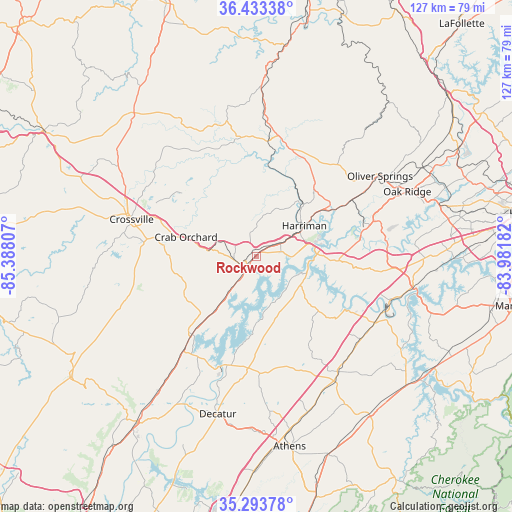
Rockwood GPS coordinates[2]
35° 51' 56.268" North, 84° 41' 5.784" West
| Map corner | latitude | longitude |
|---|---|---|
| Upper-left | 36.43338°, | -85.38807° |
| Center: | 35.86563°, | -84.68494° |
| Lower-right: | 35.29378°, | -83.98182° |
| Map W x H: | 126.7×126.7 km | = 78.7×78.7mi |
| max Lat: | 71.29058° ⇑71.1% North |
| Rockwood: | 35.86563° |
| min Lat: | ⇓28.9% South 19.06759° |
| min Long | Rockwood | max Long |
| -171.73463° | -84.68494° | -66.98998° |
| W 56.7%⇐ | ⇒43.3% E |
Elevation
Elevation of Rockwood is 272 m = 892 ft, and this is 22.8 m = 75 ft below average elevation for this country.
| Max E: |
3189 m = 10463 ft | 32.8% |
| Avg. | 294.8 m = 967 ft | |
| Rockwood | 272 m = 892 ft | |
Min E: |
-60 m = -197 ft | 67.2% |
See also: United States elevation on elevation.city.
Geographical zone
Rockwood is located in North temperate zone (between Tropic of Cancer and the Arctic Circle). Distance of this Northern Tropic circle is 1382 km =858.7 mi to South.| Distance of | km | miles | from Rockwood |
|---|---|---|---|
| North Pole | 6019.2 | 3740.2 | to North |
| Arctic Circle | 3413.3 | 2120.9 | to North |
| Tropic Cancer | 1382 | 858.7 | to South |
| Equator | 3987.9 | 2478 | to South |


Nearby cities:
15 places around Rockwood: (largest is in red/bold)
• Coalfield
29.9 km =18.6 mi,  52°
52°
• Crab Orchard
18.1 km =11.2 mi,  285°
285°
• Crossville
32.2 km =20 mi, 286°
• Fairfield Glade
23.5 km =14.6 mi,  309°
309°
• Harriman
14.1 km =8.8 mi,  57°
57°
• Kingston
16 km =9.9 mi,  83°
83°
• Lake Tansi
33.3 km =20.7 mi,  271°
271°
• Loudon
34.9 km =21.7 mi,  114°
114°
• Midtown
11 km =6.8 mi, 81°
• Oliver Springs
36.5 km =22.7 mi, 57°
• Petros
33.6 km =20.9 mi,  40°
40°
• Philadelphia
32.7 km =20.3 mi,  129°
129°
• Spring City
25 km =15.5 mi,  219°
219°
• Sweetwater
35.7 km =22.2 mi,  145°
145°
• Wartburg
27.7 km =17.2 mi,  16°
16°
Sources, notices
• [Note1] Compared only with cities in United States existing in our database
• [Src1] Map data: © OpenStreetMap contributors (CC-BY-SA)
• [Src2] Other city data from geonames.org with taken over terms of usage.
• [Src3] Geographical zone / Annual Mean Temperature by Robert A. Rohde @ Wikipedia
