Laredo geodata
Laredo (Texas) is a seat of a second-order administrative division; located in United States in America/Chicago (GMT-5) time zone. With population of 255,473 people, there are 90 cities with bigger population in this country. Compared to other cities in United States, 97.2% of cities are located further ↑North; 80.4% of cities are located further →East and 64.2% of cities have higher elevation than Laredo. Note1


Laredo GPS coordinates[2]
27° 30' 23.076" North, 99° 30' 27.144" West
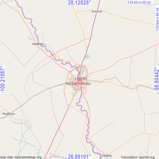
| Map corner | latitude | longitude |
|---|---|---|
| Upper-left | 28.12828°, | -100.21067° |
| Center: | 27.50641°, | -99.50754° |
| Lower-right: | 26.88101°, | -98.80442° |
| Map W x H: | 138.7×138.7 km | = 86.2×86.2mi |
| max Lat: | 71.29058° ⇑97.2% North |
| Laredo: | 27.50641° |
| min Lat: | ⇓2.8% South 19.06759° |
| min Long | Laredo | max Long |
| -171.73463° | -99.50754° | -66.98998° |
| W 19.6%⇐ | ⇒80.4% E |
Elevation
Elevation of Laredo is 132 m = 433 ft, and this is 162.8 m = 534 ft below average elevation for this country.
| Max E: |
3189 m = 10463 ft | 64.2% |
| Avg. | 294.8 m = 967 ft | |
| Laredo | 132 m = 433 ft | |
Min E: |
-60 m = -197 ft | 35.8% |
See also: Laredo elevation on elevation.city.
Geographical zone
Laredo is located in North temperate zone (between Tropic of Cancer and the Arctic Circle). Distance of this Northern Tropic circle is 452.5 km =281.2 mi to South.| Distance of | km | miles | from Laredo |
|---|---|---|---|
| North Pole | 6948.6 | 4317.7 | to North |
| Arctic Circle | 4342.7 | 2698.4 | to North |
| Tropic Cancer | 452.5 | 281.2 | to South |
| Equator | 3058.4 | 1900.4 | to South |


Nearby cities:
15 places around Laredo: (largest is in red/bold)
• Cactus
45.9 km =28.5 mi,  14°
14°
• El Cenizo
17.2 km =10.7 mi,  175°
175°
• Encinal
61.3 km =38.1 mi, 14°
• Falcon Lake Estates
74.7 km =46.4 mi,  160°
160°
• Hebbronville
84.6 km =52.6 mi,  105°
105°
• Larga Vista
7.7 km =4.8 mi,  96°
96°
• Medina
69.5 km =43.2 mi, 159°
• Pueblo Nuevo
19.6 km =12.2 mi, 95°
• Pueblo Nuevo Colonia
19.5 km =12.1 mi,  93°
93°
• Ranchos Penitas West
21.3 km =13.2 mi,  331°
331°
• Ranchos Penitas West Colonia
21 km =13 mi, 333°
• Rio Bravo
16 km =9.9 mi,  170°
170°
• San Ygnacio
52 km =32.3 mi, 172°
• Siesta Shores
76.3 km =47.4 mi, 160°
• Zapata
70.6 km =43.9 mi, 160°
Sources, notices
• [Note1] Compared only with cities in United States existing in our database
• [Src1] Map data: © OpenStreetMap contributors (CC-BY-SA)
• [Src2] Other city data from geonames.org with taken over terms of usage.
• [Src3] Geographical zone / Annual Mean Temperature by Robert A. Rohde @ Wikipedia
