Hebbronville geodata
Hebbronville (Texas) is a seat of a second-order administrative division; located in United States in America/Chicago (GMT-5) time zone. With population of 4,558 people, there are 7586 cities with bigger population in this country. Compared to other cities in United States, 97.4% of cities are located further ↑North; 79.6% of cities are located further →East and 56.4% of cities have higher elevation than Hebbronville. Note1


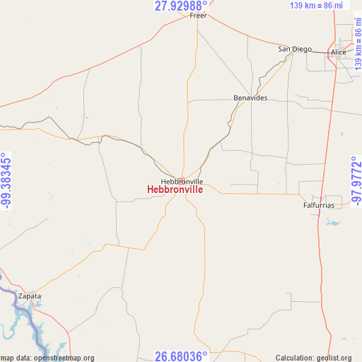
Hebbronville GPS coordinates[2]
27° 18' 24.768" North, 98° 40' 49.152" West
| Map corner | latitude | longitude |
|---|---|---|
| Upper-left | 27.92988°, | -99.38345° |
| Center: | 27.30688°, | -98.68032° |
| Lower-right: | 26.68036°, | -97.9772° |
| Map W x H: | 138.9×138.9 km | = 86.3×86.3mi |
| max Lat: | 71.29058° ⇑97.4% North |
| Hebbronville: | 27.30688° |
| min Lat: | ⇓2.6% South 19.06759° |
| min Long | Hebbronville | max Long |
| -171.73463° | -98.68032° | -66.98998° |
| W 20.4%⇐ | ⇒79.6% E |
Elevation
Elevation of Hebbronville is 174 m = 571 ft, and this is 120.8 m = 396 ft below average elevation for this country.
| Max E: |
3189 m = 10463 ft | 56.4% |
| Avg. | 294.8 m = 967 ft | |
| Hebbronville | 174 m = 571 ft | |
Min E: |
-60 m = -197 ft | 43.6% |
See also: United States elevation on elevation.city.
Geographical zone
Hebbronville is located in North temperate zone (between Tropic of Cancer and the Arctic Circle). Distance of this Northern Tropic circle is 430.3 km =267.4 mi to South.| Distance of | km | miles | from Hebbronville |
|---|---|---|---|
| North Pole | 6970.8 | 4331.5 | to North |
| Arctic Circle | 4364.9 | 2712.2 | to North |
| Tropic Cancer | 430.3 | 267.4 | to South |
| Equator | 3036.2 | 1886.6 | to South |


Nearby cities:
15 places around Hebbronville: (largest is in red/bold)
• Alice
78 km =48.5 mi,  50°
50°
• Benavides
42.1 km =26.2 mi,  39°
39°
• Coyote Acres
70.3 km =43.7 mi, 50°
• Falcon Lake Estates
74.6 km =46.4 mi,  229°
229°
• Falfurrias
53.7 km =33.4 mi,  99°
99°
• Freer
64.3 km =40 mi,  5°
5°
• Larga Vista
77 km =47.8 mi,  286°
286°
• Medina
71.6 km =44.5 mi, 233°
• Premont
55.3 km =34.4 mi,  83°
83°
• Pueblo Nuevo
65.4 km =40.6 mi, 288°
• Pueblo Nuevo Colonia
65.6 km =40.8 mi, 288°
• Rancho Alegre
75.3 km =46.8 mi, 50°
• San Diego
66.9 km =41.6 mi, 40°
• Siesta Shores
75.6 km =47 mi, 228°
• Zapata
73.5 km =45.7 mi, 232°
Sources, notices
• [Note1] Compared only with cities in United States existing in our database
• [Src1] Map data: © OpenStreetMap contributors (CC-BY-SA)
• [Src2] Other city data from geonames.org with taken over terms of usage.
• [Src3] Geographical zone / Annual Mean Temperature by Robert A. Rohde @ Wikipedia
