Gordonsville geodata
Gordonsville (Virginia) is a populated place; located in United States in America/New_York (GMT-4) time zone. With population of 1,577 people, there are 13367 cities with bigger population in this country. Compared to other cities in United States, 60.9% of cities are located further ↑North; 77.5% of cities are located further ←West and 61.1% of cities have higher elevation than Gordonsville. Note1


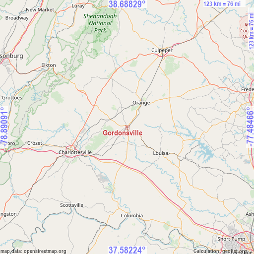
Gordonsville GPS coordinates[2]
38° 8' 14.496" North, 78° 11' 16.008" West
| Map corner | latitude | longitude |
|---|---|---|
| Upper-left | 38.68829°, | -78.89091° |
| Center: | 38.13736°, | -78.18778° |
| Lower-right: | 37.58224°, | -77.48466° |
| Map W x H: | 123×123 km | = 76.4×76.4mi |
| max Lat: | 71.29058° ⇑60.9% North |
| Gordonsville: | 38.13736° |
| min Lat: | ⇓39.1% South 19.06759° |
| min Long | Gordonsville | max Long |
| -171.73463° | -78.18778° | -66.98998° |
| W 77.5%⇐ | ⇒22.5% E |
Elevation
Elevation of Gordonsville is 149 m = 489 ft, and this is 145.8 m = 478 ft below average elevation for this country.
| Max E: |
3189 m = 10463 ft | 61.1% |
| Avg. | 294.8 m = 967 ft | |
| Gordonsville | 149 m = 489 ft | |
Min E: |
-60 m = -197 ft | 38.9% |
See also: United States elevation on elevation.city.
Geographical zone
Gordonsville is located in North temperate zone (between Tropic of Cancer and the Arctic Circle). Distance of this Northern Tropic circle is 1634.6 km =1015.7 mi to South.| Distance of | km | miles | from Gordonsville |
|---|---|---|---|
| North Pole | 5766.6 | 3583.2 | to North |
| Arctic Circle | 3160.7 | 1964 | to North |
| Tropic Cancer | 1634.6 | 1015.7 | to South |
| Equator | 4240.5 | 2634.9 | to South |


Nearby cities:
15 places around Gordonsville: (largest is in red/bold)
• Blue Ridge Shores
14.7 km =9.1 mi,  104°
104°
• Brightwood
31.6 km =19.6 mi,  359°
359°
• Charlottesville
28 km =17.4 mi,  244°
244°
• Hollymead
22.3 km =13.9 mi,  264°
264°
• Ivy
36.9 km =22.9 mi, 255°
• Lake Monticello
27.1 km =16.8 mi,  208°
208°
• Louisa
20.3 km =12.6 mi,  127°
127°
• Madison
27.7 km =17.2 mi,  347°
347°
• Merrimac
36.3 km =22.6 mi,  15°
15°
• Orange
13.8 km =8.6 mi,  29°
29°
• Palmyra
31.4 km =19.5 mi,  192°
192°
• Pantops
26.1 km =16.2 mi, 243°
• Ruckersville
19.1 km =11.9 mi,  303°
303°
• Stanardsville
28.3 km =17.6 mi,  308°
308°
• Twin Lakes
25.6 km =15.9 mi, 299°
Sources, notices
• [Note1] Compared only with cities in United States existing in our database
• [Src1] Map data: © OpenStreetMap contributors (CC-BY-SA)
• [Src2] Other city data from geonames.org with taken over terms of usage.
• [Src3] Geographical zone / Annual Mean Temperature by Robert A. Rohde @ Wikipedia
